
Beaches of Salento
Sand or rocks, free or with beach clubs, on the Adriatic or the Ionian: for every beach the water quality, the services and which winds leave it calm. Check today’s wind and pick the right coast.
57 beaches · Clear
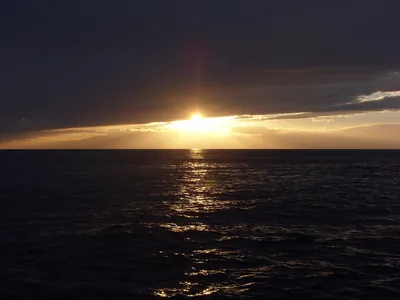 Rocks and cliffsTramontoneLong rocky shore between Porto Cupo and Lido Bruno, with short stretches of cliff and a few small sandy hollows.Free · 2 beach clubs Excellent water Natura 2000 Taranto · Ionian
- SandCeranoSandy beach below the cliffs, at the foot of the Bosco di Cerano reserve, south of Brindisi.Free · 1 beach club Excellent water Protected area Brindisi · Adriatic
- SandMarina di FellonicheSeaside spot between Leuca and San Gregorio: low rocky shore with a sandy stretch of about 300 metres, almost all free.Free · beach clubs Excellent water Natura 2000 Castrignano del Capo · Ionian
- SandPunta BufaloriaSandy beach with dunes and scrub in zone C of the Torre Guaceto reserve, largely free, with low rocks.Free · 1 beach club Excellent water Blue Flag town Protected area Carovigno · Adriatic
- SandRiva dei TessaliBeach of pale, fine sand backed by dunes, with free stretches and concession areas, between Riva dei Tessali and Borgo Pineto.Free · beach clubs Excellent water Blue Flag town Protected area Castellaneta · Ionian
- SandSpiaggia della CommendaLong sandy beach, almost all free, with dunes behind, from Campomarino towards Acquadolce, with few beach clubs.Free · 3 beach clubs Excellent water Blue Flag town Natura 2000 Maruggio · Ionian
- SandSpiaggiabellaTwo kilometres of sand and dunes, almost all free, in the Rauccio park, between Torre Rinalda and Torre Chianca.Free · 2 beach clubs Excellent water Blue Flag town Protected area Lecce · Adriatic
- Rocks and cliffsTorre Santo StefanoCliffs and rocks with small coves between the Baia dei Turchi and Otranto, from Vigna Vecchia to Mulino d'Acqua, with no sand.1 beach club Excellent water Natura 2000 Otranto · Adriatic
- SandTorre TestaSandy beach north of Brindisi, near the mouth of the Canale Giancola and the Torre Testa watchtower.Beach clubs Excellent water Natura 2000 Brindisi · Adriatic
Wind forecast by MET Norway (CC BY 4.0), for central Salento. Sources and licences: ARPA Puglia – Monitoraggio delle acque di balneazione (CC BY 4.0) · Regione Puglia – Aree di balneazione e classificazione 2024 (CC BY 4.0) · Regione Puglia – Piano Regionale delle Coste (SIT Puglia) (CC BY 4.0) · Regione Puglia – Ricognizione dei Piani comunali delle coste (A.D. 142/2025, SIT Puglia) (CC BY 4.0) · Regione Puglia – Parchi e riserve naturali (rev. 11/2022) (CC BY 4.0) · Regione Puglia – Perimetrazione dei siti Natura 2000 (12/2023) (CC BY 4.0) · Pugliapromozione – DMS Puglia, open data (stabilimenti balneari, luoghi di interesse) (CC BY 4.0) · © OpenStreetMap contributors (ODbL 1.0) · Wikimedia Commons (foto: autore e licenza su ogni foto) (CC0, PD, CC BY, CC BY-SA) · salentosagreeventi.it – luoghi (foto e testi già pubblicati) (come indicato sulle foto) · FEE Italia – Bandiera Blu 2026 (dato pubblico (elenco dei comuni premiati))