
The beach at a glance
Sandy beach north of Brindisi, near the mouth of the Canale Giancola and the Torre Testa watchtower.
- Type of coast
- Sand
- Sand 267 m
- Rocks 89 m
- Cliff 35 m
- Length
- 392 m
- Seafront
- 49% free
- 192 m free200 m leased to beach clubs
- Water quality
- Excellent · classification 2024
- Off season: latest samples of the 2026 season
- Latest samples:
- Mon 13 Jul: within limits
- Mon 15 Jun: within limits
- Tue 19 May: within limits
- Mon 20 Apr: within limits
- Natura 2000 network
- ZSC Foce Canale Giancola (IT9140009)
About the beach
Torre Testa is a stretch of coast north of Brindisi a few hundred metres long: mostly sand, with a few rocks and a short stretch of high coast. Half the beachfront is free and half has facilities.
The name comes from the area's old watchtower. A few hundred metres away the Canale Giancola flows into the sea: beyond the Brindisi-Apani coast road the channel widens into a reed bed with small pools of water, between high sandstone walls covered in Mediterranean scrub. The mouth area is part of the Foce Canale Giancola Natura 2000 site, a special area of conservation protected for its natural environment.
The data show no listed car parks nearby, so it is worth checking before you set off. On the rocks you will need water shoes. The beach faces north: with north (tramontana), north-east (grecale) and north-west (maestrale) winds the sea gets rough, while with east (levante), south-east (scirocco), south (ostro), south-west (libeccio) and west (ponente) winds it is sheltered. Further north you reach the beaches of Apani.
On the map
Stretch of beach
Events nearby
In the coming days within 5 km.
No events within 5 km in the coming days.
Things to see nearby
Beaches nearby
- PebblesSbitriPebble and sand beach north of Brindisi, between the mouth of the Canale Giancola and Sciaia, with free stretches.Free · 2 beach clubs Excellent water Brindisi · Adriatic 2.4 km away
- SandApaniLong sandy beach from the Apani rock towards Brindisi, with many beach clubs and a few free stretches.6 beach clubs Excellent water Protected area Brindisi · Adriatic 3.2 km away
- MixedSciaiaLow, jagged rocky shore near the small harbour of Brindisi, with small free sandy coves.Free Excellent water Brindisi · Adriatic 4.4 km away
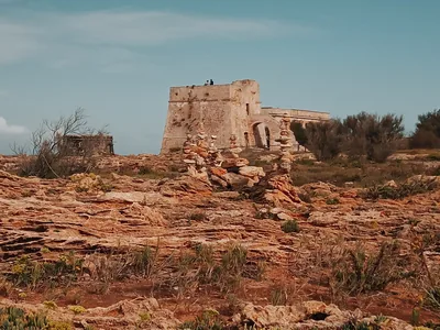 SandPunta PenneLow headland north of Brindisi with a 16th-century tower, among sandy beaches, low rocks and several beach clubs.Free · 4 beach clubs Excellent water Brindisi · Adriatic 5.6 km away
Sources and licences
The data comes from public sources; before swimming check the signs and the town’s bathing ordinances.
- ARPA Puglia – Monitoraggio delle acque di balneazione (CC BY 4.0)
- Regione Puglia – Aree di balneazione e classificazione 2024 (CC BY 4.0)
- Regione Puglia – Piano Regionale delle Coste (SIT Puglia) (CC BY 4.0)
- © OpenStreetMap contributors (ODbL 1.0)
- Regione Puglia – Ricognizione dei Piani comunali delle coste (A.D. 142/2025, SIT Puglia) (CC BY 4.0)
- Regione Puglia – Perimetrazione dei siti Natura 2000 (12/2023) (CC BY 4.0)
- Wind forecast: MET Norway (CC BY 4.0).
- Data updated: Sunday, 25 October 2026.