
Beaches in Otranto
Sand or rocks, free or with beach clubs, on the Adriatic or the Ionian: for every beach the water quality, the services and which winds leave it calm. Check today’s wind and pick the right coast.
9 beaches · Clear
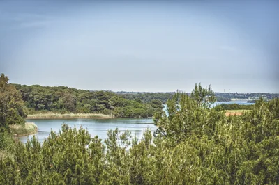 SandAliminiLong beach of very fine sand with high dunes, pine wood and shallow water, in front of the Alimini lakes, with beach clubs and free stretches.Free · 21 beach clubs Excellent water Natura 2000 Otranto · Adriatic
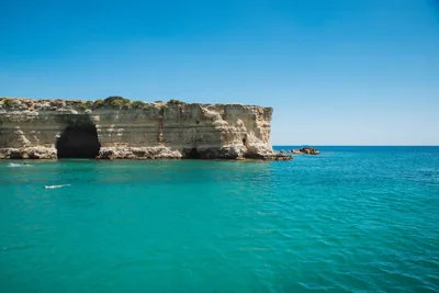 MixedBaia dei TurchiWhite sand set in the rock among pine wood and scrub, with small bays up to the Alimini and the little cove of Toraiello.Beach clubs Excellent water Natura 2000 Otranto · Adriatic
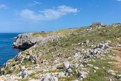 Rocks and cliffsBaia delle OrteWild coast of low rocks south of Otranto, with pine wood, freshwater springs and the bauxite quarry, in the coastal park.Free Excellent water Protected area Otranto · Adriatic
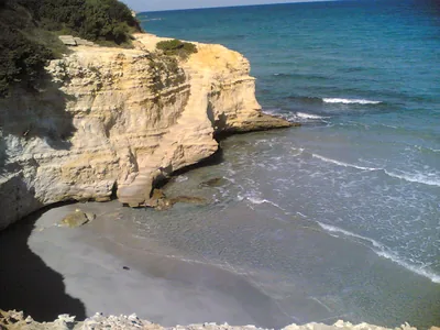 SandConca SpecchiullaCliffs with stretches of sand and dunes between Torre Sant'Andrea and Frassanito, almost all free, with only one beach club.Free · 1 beach club Excellent water Natura 2000 Otranto · Adriatic
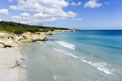 SandFrassanitoBeach of very fine white sand between high dunes and pine wood, with beach clubs and free stretches, loved by surfers and kiters.Free · 2 beach clubs Excellent water Natura 2000 Otranto · Adriatic
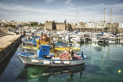 SandOtrantoTown coast of rocks and small sandy beaches, from the Castellana to the Gradoni beach, near the Idro channel.Free · 5 beach clubs Excellent water Natura 2000 Otranto · Adriatic
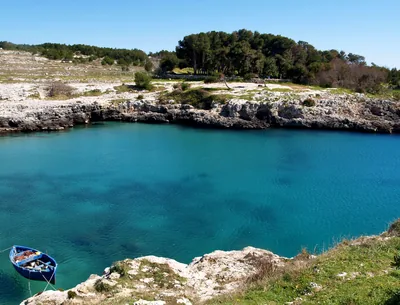 Rocks and cliffsPorto BadiscoDeep inlet between rocks and broom with a small beach in the middle, where legend has it that Aeneas landed.Beach clubs Excellent water Protected area Otranto · Adriatic
 Rocks and cliffsPunta PalascìaRugged rocky coast below the lighthouse of Punta Palascìa, the easternmost point of Italy, as far as Torre Sant'Emiliano.Free Excellent water Protected area Otranto · Adriatic
- Rocks and cliffsTorre Santo StefanoCliffs and rocks with small coves between the Baia dei Turchi and Otranto, from Vigna Vecchia to Mulino d'Acqua, with no sand.1 beach club Excellent water Natura 2000 Otranto · Adriatic
Wind forecast by MET Norway (CC BY 4.0), for central Salento. Sources and licences: ARPA Puglia – Monitoraggio delle acque di balneazione (CC BY 4.0) · Regione Puglia – Aree di balneazione e classificazione 2024 (CC BY 4.0) · Regione Puglia – Piano Regionale delle Coste (SIT Puglia) (CC BY 4.0) · Regione Puglia – Ricognizione dei Piani comunali delle coste (A.D. 142/2025, SIT Puglia) (CC BY 4.0) · Regione Puglia – Parchi e riserve naturali (rev. 11/2022) (CC BY 4.0) · Regione Puglia – Perimetrazione dei siti Natura 2000 (12/2023) (CC BY 4.0) · Pugliapromozione – DMS Puglia, open data (stabilimenti balneari, luoghi di interesse) (CC BY 4.0) · © OpenStreetMap contributors (ODbL 1.0) · Wikimedia Commons (foto: autore e licenza su ogni foto) (CC0, PD, CC BY, CC BY-SA) · salentosagreeventi.it – luoghi (foto e testi già pubblicati) (come indicato sulle foto) · FEE Italia – Bandiera Blu 2026 (dato pubblico (elenco dei comuni premiati))