
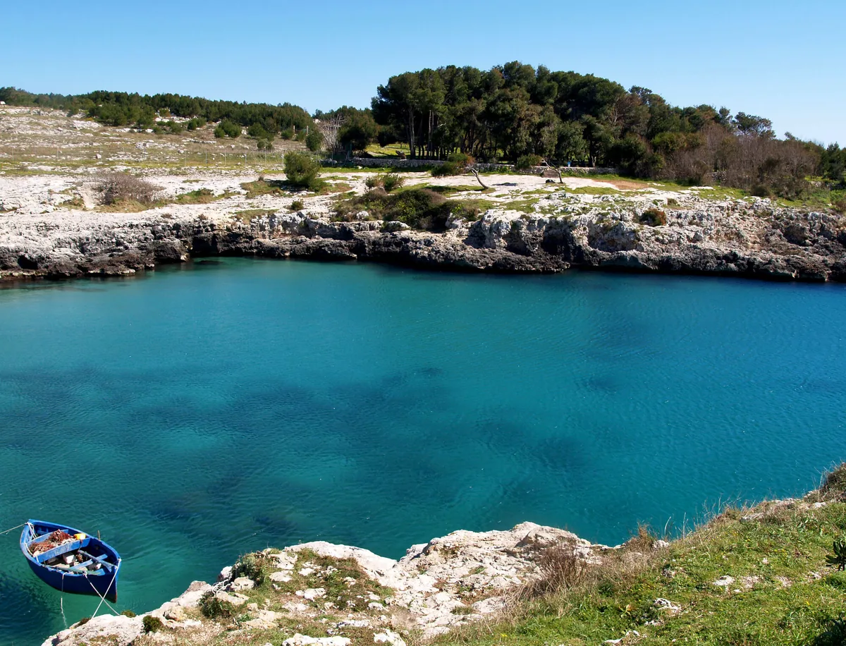
The beach at a glance
Deep inlet between rocks and broom with a small beach in the middle, where legend has it that Aeneas landed.
- Type of coast
- Rocks and cliffs
- Rocks 6,291 m
- Length
- 6,356 m
- Seafront
- 326 m free188 m leased to beach clubs
- Water quality
- Excellent · classification 2024
- Off season: latest samples of the 2026 season
- ARPA bathing areas:
- PORTO BADISCO-SCALO DI ENEA-ExcellentWed 8 Jul: within limits
- PORTO BADISCO-ATTRACCO BARCHEExcellentWed 8 Jul: within limits
- Protected area
- Parco naturale regionale Costa Otranto-S.Maria di Leuca e Bosco di Tricase
- Natura 2000 network
- ZSC Costa Otranto - Santa Maria di Leuca (IT9150002)
About the beach
Porto Badisco is a narrow, deep inlet between rocky shores covered in scrub and broom, with a small fishing village. According to legend, it was here that Aeneas, fleeing Troy, first set foot in Italy. In the middle of the bay is a little sandy beach a few dozen metres wide, with a freshwater spring rising on the left-hand side; the rest of the coast, as far as the small cove of Porto Russo, is rock, with no beach clubs.
The seabed slopes gently over the sand, then after a few dozen metres the sea becomes deep and cobalt blue: ideal for swimming with mask and fins and for diving. On the rocks you will need water shoes. A few steps from the coast is the Grotta dei Cervi, discovered in 1970, one of the most important prehistoric sites in Europe, closed to the public to protect its paintings. The area is in the Costa Otranto-Santa Maria di Leuca e Bosco di Tricase regional nature park. It is part of the Costa Otranto - Santa Maria di Leuca Natura 2000 site.
The car parks are a short walk from the bay. The inlet faces south-east: with north (tramontana), north-east (grecale), south-west (libeccio), west (ponente) and north-west (maestrale) winds it offers shelter, while with east (levante), south-east (scirocco) and south (ostro) winds the sea gets rough.
On the map
Stretch of beach
Events nearby
In the coming days within 5 km.
No events within 5 km in the coming days.
Things to see nearby
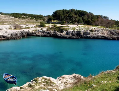 Sea and cavesPorto BadiscoThe nice small beach of Porto Badisco, nestled amid the cliffs and the
yellow brooms, is the perfect place to dive in the crystal clear sea and to
taste the delicious sea-urchins. Otranto very close
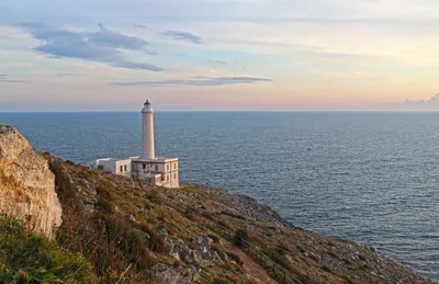 Sea and cavesPunta Palascìa and Torre Sant'EmilianoIn the easternmost point of Italy, the lighthouse of Punta Palascìa, stands
out on a rocky spur, which overlooks the intense blue sea, while at the
feet of Torre Sant’Emiliano, one can dive in the blue sea. Otranto 1.5 km away
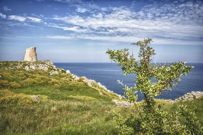 Castles, towers and palacesTorre MinervinoBuilt to defend the east coast of Salento, the Tower is a part of the
system of towers of Santa Cesarea Terme. Santa Cesarea Terme 1.6 km away
Beaches nearby
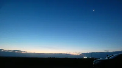 Rocks and cliffsPunta PalascìaRugged rocky coast below the lighthouse of Punta Palascìa, the easternmost point of Italy, as far as Torre Sant'Emiliano.Free Excellent water Protected area Otranto · Adriatic 3 km away
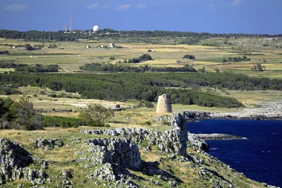 Rocks and cliffsTorre MinervinoHigh rocky coast between Porto Badisco and Santa Cesarea, with no beaches, guarded by Torre Minervino and Torre Specchia di Guardia.Free Excellent water Protected area Santa Cesarea Terme · Adriatic 3 km away
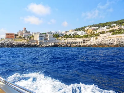 Rocks and cliffsSanta Cesarea TermeSheer rocky shore with steps, natural pools in old quarries and sulphurous thermal waters, below the town's villas.2 beach clubs Excellent water Natura 2000 Santa Cesarea Terme · Adriatic 5.6 km away
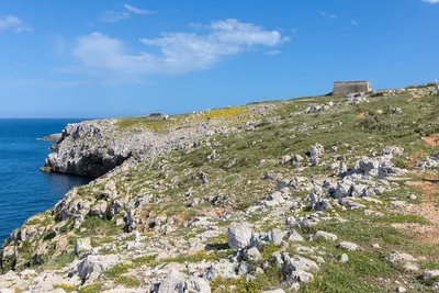 Rocks and cliffsBaia delle OrteWild coast of low rocks south of Otranto, with pine wood, freshwater springs and the bauxite quarry, in the coastal park.Free Excellent water Protected area Otranto · Adriatic 6.2 km away
Sources and licences
The data comes from public sources; before swimming check the signs and the town’s bathing ordinances.
- ARPA Puglia – Monitoraggio delle acque di balneazione (CC BY 4.0)
- Regione Puglia – Aree di balneazione e classificazione 2024 (CC BY 4.0)
- Regione Puglia – Piano Regionale delle Coste (SIT Puglia) (CC BY 4.0)
- © OpenStreetMap contributors (ODbL 1.0)
- Regione Puglia – Ricognizione dei Piani comunali delle coste (A.D. 142/2025, SIT Puglia) (CC BY 4.0)
- Regione Puglia – Parchi e riserve naturali (rev. 11/2022) (CC BY 4.0)
- Regione Puglia – Perimetrazione dei siti Natura 2000 (12/2023) (CC BY 4.0)
- Wikimedia Commons (foto: autore e licenza su ogni foto) (CC0, PD, CC BY, CC BY-SA)
- salentosagreeventi.it – luoghi (foto e testi già pubblicati) (come indicato sulle foto)
- Wind forecast: MET Norway (CC BY 4.0).
- Photos: Nunzio Pacella · Regione Puglia
- Photos: The original uploader was Marzoide88 at Italian Wikipedia ., CC BY-SA 3.0 · Wikimedia Commons
- Photos: paolo dagani, CC BY 3.0 · Wikimedia Commons
- Photos: Patrice78500, CC BY-SA 4.0 · Wikimedia Commons
- Photos: Patrice78500, CC BY-SA 4.0 · Wikimedia Commons
- Photos: Marzoide88, CC BY-SA 3.0 · Wikimedia Commons
- Photos: Hydruntum, CC BY-SA 3.0 · Wikimedia Commons
- Photos: Patrice78500, CC BY-SA 4.0 · Wikimedia Commons
- Photos: Patrice78500, CC BY-SA 4.0 · Wikimedia Commons
- Photos: Patrice78500, CC BY-SA 4.0 · Wikimedia Commons
- Data updated: Sunday, 25 October 2026.