
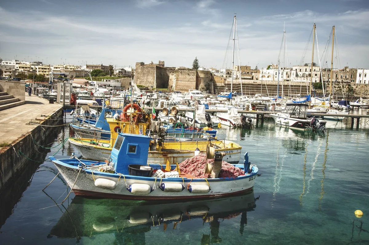
The beach at a glance
Town coast of rocks and small sandy beaches, from the Castellana to the Gradoni beach, near the Idro channel.
- Type of coast
- Sand
- Sand 1,289 m
- Rocks 1,047 m
- Cliff 770 m
- Man-made 464 m
- Length
- 3,570 m
- Seafront
- 53% free
- 1,728 m free1,510 m leased to beach clubs
- Water quality
- Excellent · classification 2024
- Off season: latest samples of the 2026 season
- ARPA bathing areas:
- CASTELLANA TRAFILI-SCARICO CITTADINOExcellentTue 7 Jul: within limits
- MADONNA D'ALTO MAREExcellentTue 7 Jul: within limits
- BAIA-VICINO CANALE IDROExcellentTue 7 Jul: within limits
- Natura 2000 network
- ZSC Alimini (IT9150011)
- Coastal erosion
- medium
About the beach
The Otranto stretch joins the rocky coast north of the town, towards the Castellana and the Madonna dell'Altomare, to the town beach of the Gradoni, near the Idro channel. In all it is about three and a half kilometres, mostly rocks, with about 1.3 kilometres of sand and a few stretches of quays and sea defences. There are five beach clubs and just over half the seafront is free.
The town beach is good for families and is a short walk from the historic centre: the walls with the Porta Alfonsina, the Aragonese castle, the Byzantine church of San Pietro and the cathedral with the Tree of Life mosaic and the chapel of the Holy Martyrs, which commemorates the eight hundred people of Otranto killed after the Turkish siege of 1480. On the rocks of the north coast you will need water shoes. It is part of the Alimini Natura 2000 site.
There are many car parks close to the centre. The coast faces east: with north (tramontana), south (ostro), south-west (libeccio), west (ponente) and north-west (maestrale) winds it is sheltered, while north-east (grecale), east (levante) and south-east (scirocco) winds make the sea rough.
On the map
Stretch of beachBeach club
Beach clubs
On this stretch of beach or less than 300 m away.
Events nearby
In the coming days within 5 km.
Tamburellisti Di Otranto in Concert
The Tamburellisti di Otranto perform traditional Salentine pizzica.
Things to see nearby
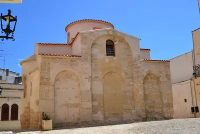 Churches and cryptsBasilica of San PietroA jewel of Byzantine art, the Church of San Pietro is one of the most
important medieval buildings in southern Italy. Otranto very close
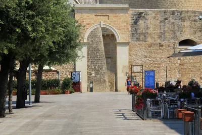 Castles, towers and palacesPorta AlfonsinaAlso known as Torre Alfonsina, it is the door of access to the ancient
heart of the city of Martiri. Otranto very close
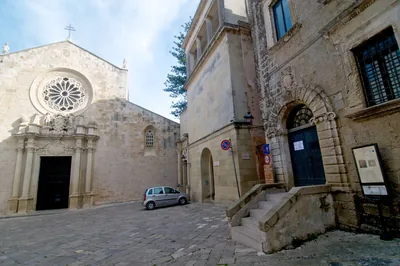 Museums and theatresDiocesan Museum of Sacred ArtThe museum collects artifacts, works of art and liturgical objects ranging
from the 16th to the 18th century that tell the story of Otranto's history
and spirituality. Otranto very close
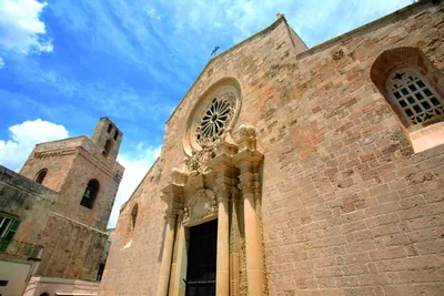 Churches and cryptsCathedral of Maria Santissima AnnunziataThe extraordinary mosaic of the Tree of Life makes a visit to the Otranto
Cathedral unique, where the memory of the bloody Turkish siege lives on in
the ossuary of the Chapel of the Holy Martyrs. Otranto very close
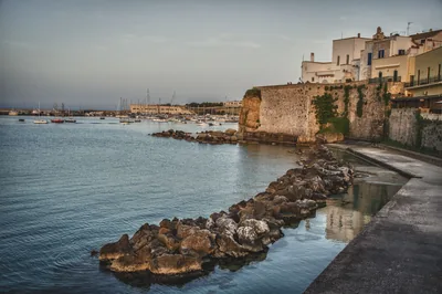 Castles, towers and palacesTown wallProtected by a town wall in the heart of Otranto. Otranto very close
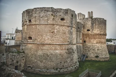 Castles, towers and palacesAragonese Castle of OtrantoKeeping vigil over Italy's most easterly town, The Castle of Otranto is a
fascinating fortress that looks eastwards in memory of past Saracen
attacks. Otranto very close
Beaches nearby
- Rocks and cliffsTorre Santo StefanoCliffs and rocks with small coves between the Baia dei Turchi and Otranto, from Vigna Vecchia to Mulino d'Acqua, with no sand.1 beach club Excellent water Natura 2000 Otranto · Adriatic 2.1 km away
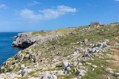 Rocks and cliffsBaia delle OrteWild coast of low rocks south of Otranto, with pine wood, freshwater springs and the bauxite quarry, in the coastal park.Free Excellent water Protected area Otranto · Adriatic 2.9 km away
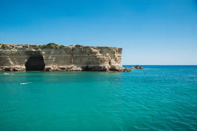 MixedBaia dei TurchiWhite sand set in the rock among pine wood and scrub, with small bays up to the Alimini and the little cove of Toraiello.Beach clubs Excellent water Natura 2000 Otranto · Adriatic 4.3 km away
 Rocks and cliffsPunta PalascìaRugged rocky coast below the lighthouse of Punta Palascìa, the easternmost point of Italy, as far as Torre Sant'Emiliano.Free Excellent water Protected area Otranto · Adriatic 6.2 km away
Sources and licences
The data comes from public sources; before swimming check the signs and the town’s bathing ordinances.
- ARPA Puglia – Monitoraggio delle acque di balneazione (CC BY 4.0)
- Regione Puglia – Aree di balneazione e classificazione 2024 (CC BY 4.0)
- Regione Puglia – Piano Regionale delle Coste (SIT Puglia) (CC BY 4.0)
- © OpenStreetMap contributors (ODbL 1.0)
- Regione Puglia – Ricognizione dei Piani comunali delle coste (A.D. 142/2025, SIT Puglia) (CC BY 4.0)
- Regione Puglia – Perimetrazione dei siti Natura 2000 (12/2023) (CC BY 4.0)
- Pugliapromozione – DMS Puglia, open data (stabilimenti balneari, luoghi di interesse) (CC BY 4.0)
- Wikimedia Commons (foto: autore e licenza su ogni foto) (CC0, PD, CC BY, CC BY-SA)
- salentosagreeventi.it – luoghi (foto e testi già pubblicati) (come indicato sulle foto)
- Wind forecast: MET Norway (CC BY 4.0).
- Photos: Leonardo D'Angelo · Regione Puglia
- Photos: Enric, CC BY-SA 4.0 · Wikimedia Commons
- Photos: Bernard Gagnon, CC0 · Wikimedia Commons
- Photos: Carlo Pelagalli, CC BY-SA 3.0 · Wikimedia Commons
- Photos: Carlo Pelagalli, CC BY-SA 3.0 · Wikimedia Commons
- Photos: Carlo Pelagalli, CC BY-SA 3.0 · Wikimedia Commons
- Photos: Arcona B&B, CC BY 3.0 · Wikimedia Commons
- Photos: Falk2, CC BY-SA 4.0 · Wikimedia Commons
- Photos: Patrice78500, CC BY-SA 4.0 · Wikimedia Commons
- Photos: Falk2, CC BY-SA 4.0 · Wikimedia Commons
- Data updated: Sunday, 25 October 2026.