
The beach at a glance
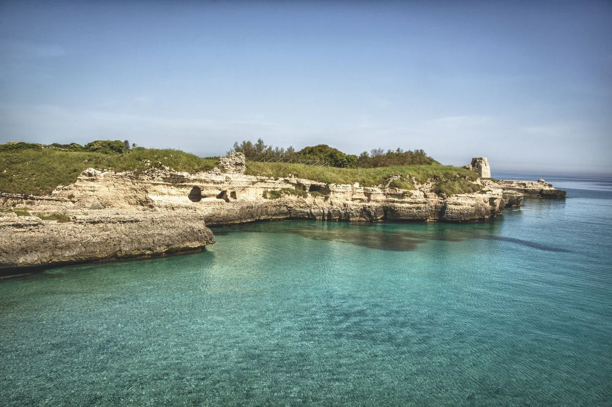
Cliffs and rocks with no beach between Roca Li Posti and Roca Vecchia, with the archaeological area and the Grotta della Poesia.
- Type of coast
- Rocks and cliffs
- Rocks 1,623 m
- Cliff 4,756 m
- Length
- 6,379 m
- Seafront
- 44% free
- 711 m free891 m leased to beach clubs
- Water quality
- Excellent · classification 2024
- Off season: latest samples of the 2026 season
- ARPA bathing areas:
- SPIAGGETTA ROCA LI POSTIExcellentTue 7 Jul: within limits
- TORRE DI ROCA VECCHIAExcellentTue 7 Jul: within limits
- Blue Flag town
- Melendugno has the Blue Flag this year
About the beach
There is no sand at Roca: over six kilometres of cliffs and rocky shore, between the village of Roca Li Posti and the archaeological area of Roca Vecchia. Small coves open along the rock, some with a beach club, but you almost always get into the water from the rocks: you will need water shoes and a little care.
The best-known spot is the Grotta della Poesia, a large circular open-air karst basin: a stairway cut into the rock leads down to the sea, and from the edge, about four metres high, the boldest dive in. The name comes from the medieval Greek 'posia', a place where fresh water was found. The nearby Poesia Piccola preserves votive inscriptions to the Messapian god Thator Andirahas. Above stands the watchtower of 1568, next to the walls of the village abandoned because of pirate raids.
The car parks are close by. The coast faces north-east: with south-east (scirocco), south-west (libeccio), west (ponente) and north-west (maestrale) winds it is sheltered, with north (tramontana), north-east (grecale) and east (levante) winds the sea gets rough. Melendugno is a Blue Flag municipality.
On the map
Stretch of beachBeach club
Beach clubs
On this stretch of beach or less than 300 m away.
Rokamel
Kum
Coiba
Events nearby
In the coming days within 5 km.
No events within 5 km in the coming days.
Things to see nearby
 Nature and gardensSites of community interest Torre dell'Orso and Palude dei TamariHistory and nature coexist in the area of Melendugno with the ancient
settlements of Roca Vecchia, the caves and beaches of Torre dell’Orso and
the unspoiled landscape of Palude dei Tamari. Melendugno very close
 Sea and cavesRocaRoca, caressed by the crystal-clear water and surrounded by the rocky
coast, offers visitors an amazing bathe inside the cave Grotta della
Poesia. Melendugno 1 km away
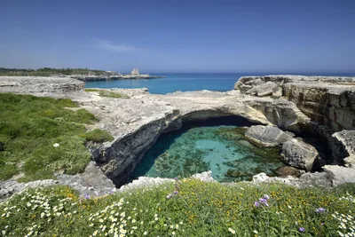 Sea and cavesCaves Poesia Piccola and Poesia GrandeThe appealing rocks of the Caves of Roca are one of the most fascinating
spots along the Adriatic coastline in Salento. Melendugno 1.1 km away
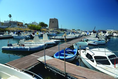 Sea and cavesSan Foca harbourNorth of the port of Otranto lies the port of Santa Foca, protected to the north by a curved breakwater and to the south by an underwater… Melendugno 1.7 km away
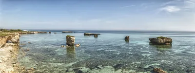 Sea and cavesSan FocaAlong the rocky coast of San Foca, there are two sandy coves, amid caves
and sea stacks which come out of the blue sea. Melendugno 1.8 km away
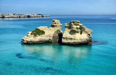 Sea and cavesTorre dell'OrsoA short stroll from the fine, white-sand beach of Torre dell'Orso, the
majestic sea stacks Due Sorelle jut out of the crystal-clear waters of the
sea. Melendugno 2.7 km away
Beaches nearby
- SandSan FocaTwo sandy inlets either side of the harbour, between low rocks and sea stacks, in the fishing village of San Foca.Free · 10 beach clubs Excellent water Blue Flag town Melendugno · Adriatic 1.3 km away
- SandTorre dell'OrsoCrescent bay of very fine white sand between the tower and the cliff, with pine wood and dunes behind and the Due Sorelle offshore.8 beach clubs Excellent water Blue Flag town Natura 2000 Melendugno · Adriatic 2.7 km away
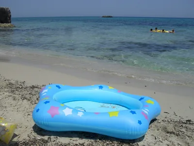 SandTorre Specchia RuggeriCliff coast with sandy coves, open to the winds and popular with surfers and kiters, north of San Foca.Free · 2 beach clubs Excellent water Blue Flag town Melendugno · Adriatic 4.3 km away
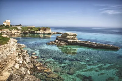 Rocks and cliffsTorre Sant'AndreaJagged limestone rock with sea stacks, small caves and a tiny beach in the minute harbour, below the chequered lighthouse.Free Excellent water Blue Flag town Melendugno · Adriatic 4.4 km away
Sources and licences
The data comes from public sources; before swimming check the signs and the town’s bathing ordinances.
- ARPA Puglia – Monitoraggio delle acque di balneazione (CC BY 4.0)
- Regione Puglia – Aree di balneazione e classificazione 2024 (CC BY 4.0)
- Regione Puglia – Piano Regionale delle Coste (SIT Puglia) (CC BY 4.0)
- © OpenStreetMap contributors (ODbL 1.0)
- Regione Puglia – Ricognizione dei Piani comunali delle coste (A.D. 142/2025, SIT Puglia) (CC BY 4.0)
- Wikimedia Commons (foto: autore e licenza su ogni foto) (CC0, PD, CC BY, CC BY-SA)
- salentosagreeventi.it – luoghi (foto e testi già pubblicati) (come indicato sulle foto)
- FEE Italia – Bandiera Blu 2026 (dato pubblico (elenco dei comuni premiati))
- Wind forecast: MET Norway (CC BY 4.0).
- Photos: Leonardo D'Angelo · Regione Puglia
- Photos: Freddyballo, CC BY-SA 3.0 · Wikimedia Commons
- Photos: Abbrey82, CC BY-SA 4.0 · Wikimedia Commons
- Photos: Bultro, CC BY-SA 4.0 · Wikimedia Commons
- Photos: Palickap, CC BY-SA 4.0 · Wikimedia Commons
- Photos: Palickap, CC BY-SA 4.0 · Wikimedia Commons
- Photos: Palickap, CC BY-SA 4.0 · Wikimedia Commons
- Photos: Palickap, CC BY-SA 4.0 · Wikimedia Commons
- Photos: Freddyballo, CC BY-SA 3.0 · Wikimedia Commons
- Photos: Psymark, CC BY-SA 4.0 · Wikimedia Commons
- Data updated: Sunday, 25 October 2026.