
Sand Blue Flag town Excellent water Protected areaFor families
Torre San Giovanni
Ugento (LE)· Sea: Ionian
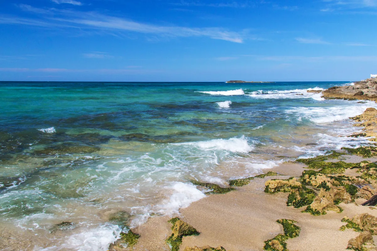
The beach at a glance
Long beach of fine golden sand south of the village, among low dunes, pine wood and beach clubs, in the Ugento park.
- Type of coast
- Sand
- Sand 2,225 m
- Man-made 32 m
- Length
- 2,257 m
- Seafront
- 50% free
- 1,118 m free1,139 m leased to beach clubs
- Water quality
- Excellent · classification 2024
- Off season: latest samples of the 2026 season
- Latest samples:
- Mon 13 Jul: within limits
- Mon 15 Jun: within limits
- Mon 18 May: within limits
- Mon 20 Apr: within limits
- Blue Flag town
- Ugento has the Blue Flag this year
- Protected area
- Parco naturale regionale Litorale di Ugento
- Natura 2000 network
- ZSC Litorale di Ugento (IT9150009)
- Coastal erosion
- medium
About the beach
The Torre San Giovanni beach opens south of the village: over two kilometres of fine golden sand, with low dunes covered in Mediterranean scrub and a large pine wood overlooking the sea. The beachfront is split almost evenly between free stretches and beach clubs, some of which list aids for people with disabilities. It is suitable for families.
Behind the beach stretches a long, once marshy area, drained with channels, along with some holiday villages and campsites. In the village there are the small harbour and the lighthouse of 1932, built on the remains of the 16th-century tower and recognisable by its black-and-white chequered façade; at the foot of the tower are stretches of Messapian walls from the ancient landing place of Ugento. The coastline is in the Litorale di Ugento regional nature park, with its protection rules, and is subject to erosion.
The car parks are a short distance away. Ugento is a Blue Flag municipality. The beach faces south-west: with north (tramontana), north-east (grecale), east (levante), south-east (scirocco) and north-west (maestrale) winds it is sheltered, with south (ostro), south-west (libeccio) and west (ponente) winds the sea gets rough. It is part of the Litorale di Ugento Natura 2000 site.
On the map
Stretch of beachBeach club
Beach clubs
On this stretch of beach or less than 300 m away.
Fontanelle s.r.l.
- Services for people with disabilities: sedia JOB
Astor Beach
Vivosa
Coco Loco
Lido Malibù
Bora Bora
7 more beach clubs
Lido Sabbioso
Hyencos Beach
Bar · Quotidiani · Punto ristoro
- Parking
Lido Isola Beach
Bar · Ristorante · Punto ristoro
Lido Il Molo
- Services for people with disabilities: sedia JOB
- Parking
Lido Onda Marina
- Services for people with disabilities: carrozzine
Lido Oasi degli Angeli
Bar · Ristorante
- Services for people with disabilities: parcheggi riservati
- Parking
Hotel Poseidone
Events nearby
In the coming days within 5 km.
No events within 5 km in the coming days.
Things to see nearby
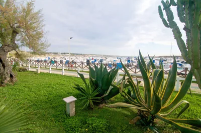 Sea and cavesTorre San Giovanni harbourThe marina is located south of Gallipoli, near Torre San Giovanni d'Ugento, with an outer jetty, a submerged jetty, and a shore platform. Ugento 1.2 km away
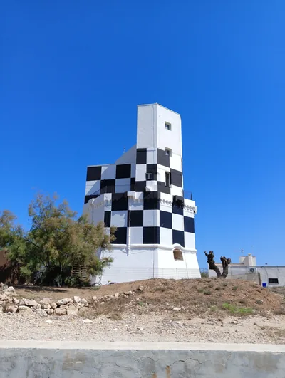 Castles, towers and palacesTorre San Giovanni LighthouseBuilding symbol of Torre San Giovanni, important maritime fraction of the
city of Ugento. Ugento 1.4 km away
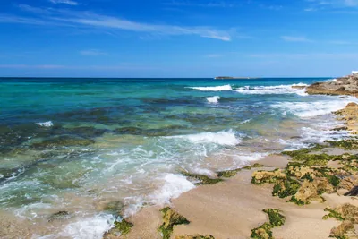 Sea and cavesTorre San GiovanniFrom the long sandy and golden beach, as far as the scented pine forest,
from the dunes dotted with plants typical of the Mediterranean scrub, as
far as the small island which appears in the turquoise sea: Torre… Ugento 2.3 km away
Beaches nearby
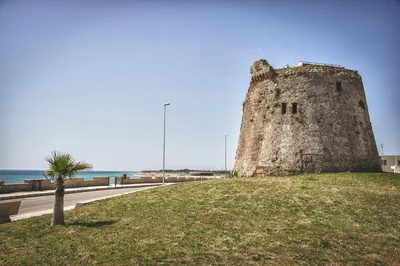 SandTorre MozzaLong beach of very fine sand sloping gently into the water, with high dunes and scrub behind, in the Ugento park.Free · 9 beach clubs Excellent water Blue Flag town Protected area Ugento · Ionian 3.1 km away
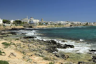 Rocks and cliffsTorre San Giovanni – Le PazzeCoast of low rocks north of Torre San Giovanni, facing the isola delle Pazze, with many free stretches, in the Ugento park.Free · beach clubs Excellent water Blue Flag town Protected area Ugento · Ionian 3.3 km away
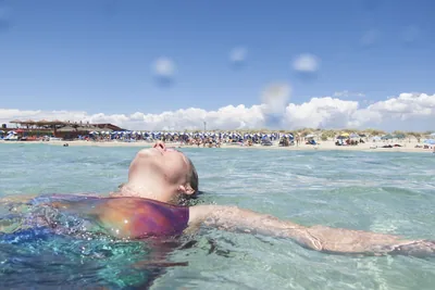 SandLido MariniGolden sandy beach almost two kilometres long with dunes and low rocks, with free stretches and beach clubs, between Salve and Ugento.Free · 6 beach clubs Excellent water Blue Flag town Protected area Ugento · Ionian 5.3 km away
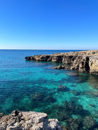 Rocks and cliffsPosto RossoLow rocky shore with small free bays, flat rocks that emerge at low tide and a freshwater spring.Free Excellent water Natura 2000 Alliste · Ionian 5.6 km away
Sources and licences
The data comes from public sources; before swimming check the signs and the town’s bathing ordinances.
- ARPA Puglia – Monitoraggio delle acque di balneazione (CC BY 4.0)
- Regione Puglia – Aree di balneazione e classificazione 2024 (CC BY 4.0)
- Regione Puglia – Piano Regionale delle Coste (SIT Puglia) (CC BY 4.0)
- © OpenStreetMap contributors (ODbL 1.0)
- Regione Puglia – Ricognizione dei Piani comunali delle coste (A.D. 142/2025, SIT Puglia) (CC BY 4.0)
- Regione Puglia – Parchi e riserve naturali (rev. 11/2022) (CC BY 4.0)
- Regione Puglia – Perimetrazione dei siti Natura 2000 (12/2023) (CC BY 4.0)
- Pugliapromozione – DMS Puglia, open data (stabilimenti balneari, luoghi di interesse) (CC BY 4.0)
- Wikimedia Commons (foto: autore e licenza su ogni foto) (CC0, PD, CC BY, CC BY-SA)
- salentosagreeventi.it – luoghi (foto e testi già pubblicati) (come indicato sulle foto)
- FEE Italia – Bandiera Blu 2026 (dato pubblico (elenco dei comuni premiati))
- Wind forecast: MET Norway (CC BY 4.0).
- Photos: Paolo Laku · Regione Puglia
- Photos: Krystal 981, CC BY-SA 3.0 · Wikimedia Commons
- Photos: Krystal 981, CC BY-SA 3.0 · Wikimedia Commons
- Photos: Krystal 981, CC BY-SA 3.0 · Wikimedia Commons
- Photos: Falk2, CC BY-SA 4.0 · Wikimedia Commons
- Photos: Falk2, CC BY-SA 4.0 · Wikimedia Commons
- Photos: Falk2, CC BY-SA 4.0 · Wikimedia Commons
- Photos: Falk2, CC BY-SA 4.0 · Wikimedia Commons
- Photos: Krystal 981, CC BY-SA 3.0 · Wikimedia Commons
- Photos: Mario Pancella, CC BY-SA 3.0 · Wikimedia Commons
- Data updated: Sunday, 25 October 2026.