
Rocks and cliffs Excellent water Natura 2000
Santa Cesarea Terme
Santa Cesarea Terme (LE)· Sea: Adriatic
The beach at a glance
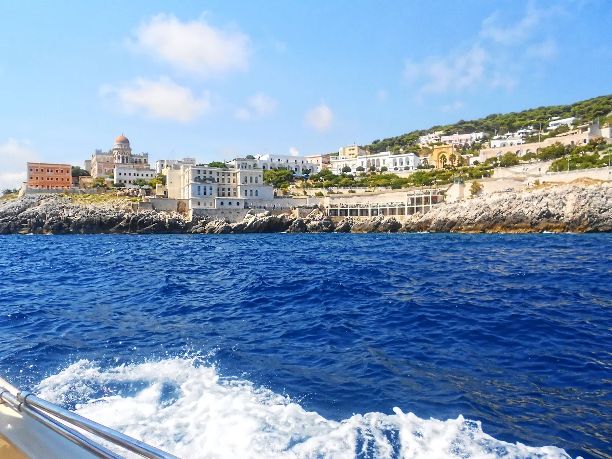
Sheer rocky shore with steps, natural pools in old quarries and sulphurous thermal waters, below the town's villas.
- Type of coast
- Rocks and cliffs
- Rocks 2,511 m
- Cliff 1,646 m
- Man-made 145 m
- Length
- 4,302 m
- Seafront
- 0% free
- 0 m free1,092 m leased to beach clubs
- Water quality
- Excellent · classification 2024
- Off season: latest samples of the 2026 season
- ARPA bathing areas:
- 50 M V.SO PALAZZO TAMBORRINO SCAR.TERMEExcellentWed 8 Jul: within limits
- 50 M V.SO PALAZZO STICCHI SCAR.TERMEExcellentWed 8 Jul: within limits
- GLI ARCHI-S.CESAREA TERMEExcellentWed 8 Jul: within limits
- Natura 2000 network
- ZSC Costa Otranto - Santa Maria di Leuca (IT9150002)
About the beach
At Santa Cesarea Terme the coast is all rock: over four kilometres of rocky shore, partly sheer, from Palazzo Tamborrino to the Archi, with water that gets deep straight away. You go down to the sea by steps and paths in the rock, public and private. From the 'Piscine' descent you reach irregular natural pools, cut into the old quarries where stone was extracted by the sea.
In the town some beach clubs are built into the rock, for those who do not like wild rocks, and there is also a swimming pool built a few metres from the shore. Next to the spa is the sulphurous pool: the waters arrive at about 30 degrees from the Fetida, Sulfurea, Gattula and Solfatara caves. Above the rocky shore stands out the dome of Villa Sticchi, built at the end of the 19th century. On the rocks you will need water shoes. It is part of the Costa Otranto - Santa Maria di Leuca Natura 2000 site.
The car parks are close by. The coast faces south-east: with north (tramontana), north-east (grecale), south-west (libeccio), west (ponente) and north-west (maestrale) winds it is sheltered, with east (levante), south-east (scirocco) and south (ostro) winds the sea gets rough.
On the map
Stretch of beachBeach club
Beach clubs
On this stretch of beach or less than 300 m away.
Events nearby
In the coming days within 5 km.
No events within 5 km in the coming days.
Things to see nearby
 Sea and cavesSanta Cesarea Terme BeachSpa pools, old quarries and coves: Santa Cesarea Terme offers an ancient
and appealing view by the sea. Santa Cesarea Terme very close
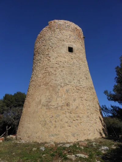 Castles, towers and palacesTorre Santa CesareaAlso known as Torre Belvedere, is one of the many defensive towers, built
in the 16th century, all along the coast of Salento. Santa Cesarea Terme very close
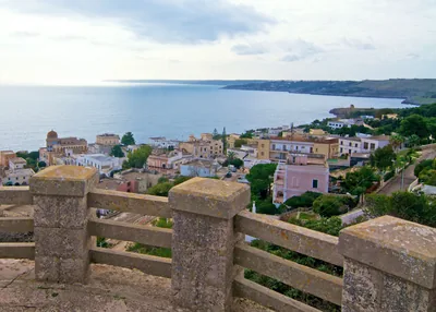 Nature and gardensParco BelvedereJust a few meters from the beautiful Adriatic coast, the Belvedere Park
pine forest is a gathering place for vacationers and a location for events. Santa Cesarea Terme very close
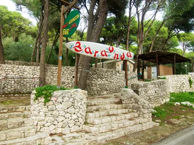 Nature and gardensRobinson ParkPine canopies provide coolness in Santa Cesarea's Robinson Park, from which
there is a magnificent view a short distance from the sea. Santa Cesarea Terme very close
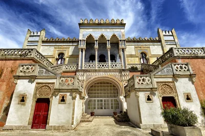 Castles, towers and palacesVilla SticchiVilla Sticchi looms over the Adriatic Sea with its eastern dome and has
been shaping the skyline of Santa Cesarea Terme since the 19th century. Santa Cesarea Terme very close
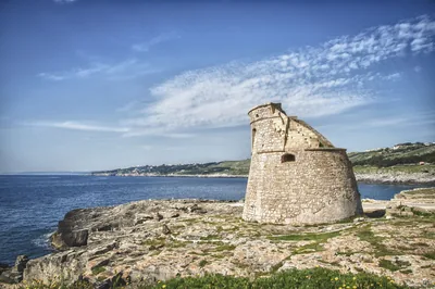 Castles, towers and palacesTorre Porto MiggianoOne of the watchtowers located on the Adriatic coast, it was built to
protect the port of Miggiano from the Saracens. Santa Cesarea Terme 1.2 km away
Beaches nearby
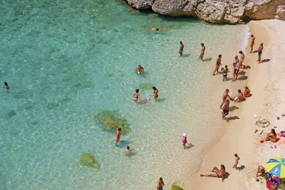 Rocks and cliffsPorto MiggianoSmall cove between twenty-metre cliffs, reached by about a hundred steps, below the 16th-century tower.Free Excellent water Protected area Santa Cesarea Terme · Adriatic 1.3 km away
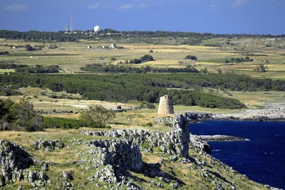 Rocks and cliffsTorre MinervinoHigh rocky coast between Porto Badisco and Santa Cesarea, with no beaches, guarded by Torre Minervino and Torre Specchia di Guardia.Free Excellent water Protected area Santa Cesarea Terme · Adriatic 2.7 km away
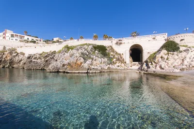 Rocks and cliffsCastro MarinaRocky shores to dive from into a sea ranging from green to blue, between the harbour, the Grotta Zinzulusa and the Sorgente.1 beach club Excellent water Blue Flag town Protected area Castro · Adriatic 3.9 km away
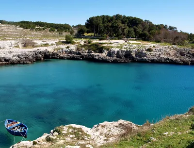 Rocks and cliffsPorto BadiscoDeep inlet between rocks and broom with a small beach in the middle, where legend has it that Aeneas landed.Beach clubs Excellent water Protected area Otranto · Adriatic 5.6 km away
Sources and licences
The data comes from public sources; before swimming check the signs and the town’s bathing ordinances.
- ARPA Puglia – Monitoraggio delle acque di balneazione (CC BY 4.0)
- Regione Puglia – Aree di balneazione e classificazione 2024 (CC BY 4.0)
- Regione Puglia – Piano Regionale delle Coste (SIT Puglia) (CC BY 4.0)
- © OpenStreetMap contributors (ODbL 1.0)
- Regione Puglia – Ricognizione dei Piani comunali delle coste (A.D. 142/2025, SIT Puglia) (CC BY 4.0)
- Regione Puglia – Perimetrazione dei siti Natura 2000 (12/2023) (CC BY 4.0)
- Pugliapromozione – DMS Puglia, open data (stabilimenti balneari, luoghi di interesse) (CC BY 4.0)
- Wikimedia Commons (foto: autore e licenza su ogni foto) (CC0, PD, CC BY, CC BY-SA)
- salentosagreeventi.it – luoghi (foto e testi già pubblicati) (come indicato sulle foto)
- Wind forecast: MET Norway (CC BY 4.0).
- Photos: Paolo Laku · Regione Puglia
- Photos: Laurent Massoptier, https://www.flickr.com/people/loloieg/ http://loloieg.free.fr/blog/index.php, CC BY-SA 2.0 · Wikimedia Commons
- Photos: Federico Stefanelli (nelli federico photo), CC BY-SA 4.0 · Wikimedia Commons
- Photos: Patrick Nouhailler's…, CC BY-SA 3.0 · Wikimedia Commons
- Photos: Patrick Nouhailler's…, CC BY-SA 3.0 · Wikimedia Commons
- Photos: Art Anderson, CC BY-SA 3.0 · Wikimedia Commons
- Photos: Lupiae, CC BY-SA 3.0 · Wikimedia Commons
- Photos: Patrick Nouhailler's…, CC BY-SA 3.0 · Wikimedia Commons
- Photos: Patrick Nouhailler's…, CC BY-SA 3.0 · Wikimedia Commons
- Photos: Patrick Nouhailler's…, CC BY-SA 3.0 · Wikimedia Commons
- Data updated: Sunday, 25 October 2026.