
Rocks and cliffs Blue Flag town Excellent waterFor families
Torre Vado
Morciano di Leuca (LE),Patù (LE)· Sea: Ionian
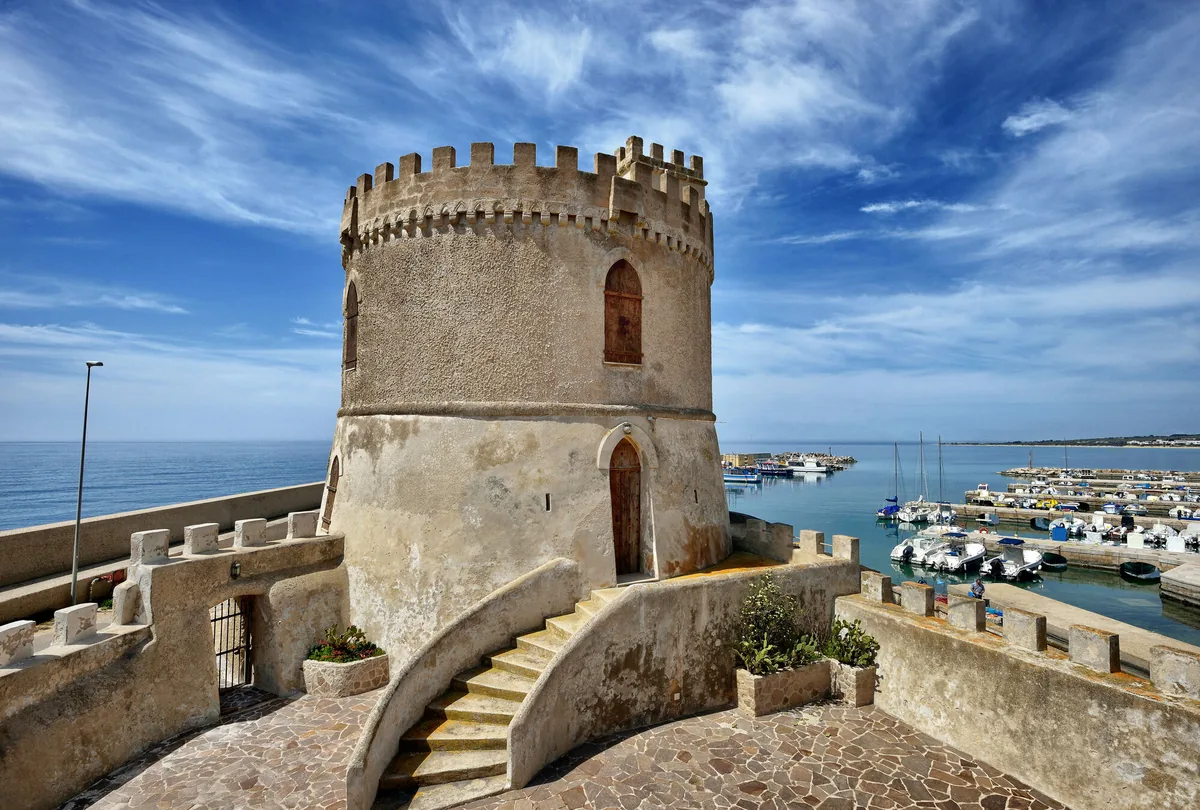
The beach at a glance
Low, flat rocky shore with freshwater springs, a small harbour and a 16th-century tower; to the east, the pebble beach.
- Type of coast
- Rocks and cliffs
- Pebbles 1,783 m
- Rocks 1,607 m
- Man-made 149 m
- Length
- 3,589 m
- Seafront
- 285 m free0 m leased to beach clubs
- Water quality
- Excellent · classification 2024
- Off season: latest samples of the 2026 season
- ARPA bathing areas:
- MACCHIE DI ROMANOExcellentMon 13 Jul: within limits
- TORRE VADO-ALLA TORREExcellentMon 13 Jul: within limits
- Blue Flag town
- Morciano di Leuca has the Blue Flag this year
About the beach
Torre Vado takes its name from the 16th-century watchtower that stands a few metres from the shore, next to the small harbour used mainly by fishing boats. The coast is low, flat rocks, with a short stretch of sand near the harbour; to the east, at Macchie di Romano, stretches a pebble beach. To get into the water from the rocks and pebbles you will need water shoes.
The best-known spot is the Sorgenti: fresh water, used since ancient times, wells up among the rocks and makes the sea clear and cold. The seabed stays shallow for a few metres from the shore and then drops. The coast is very busy, with free stretches and areas with facilities. The tower communicated by sight with Torre Pali to the north and with the San Gregorio tower to the south.
There are plenty of car parks close by. The coast faces south-west: with north (tramontana), north-east (grecale), east (levante), south-east (scirocco) and north-west (maestrale) winds the sea is calm, with south (ostro), south-west (libeccio) and west (ponente) winds it gets rough.
On the map
Stretch of beachBeach club
Beach clubs
On this stretch of beach or less than 300 m away.
Controvento Beach Club
Events nearby
In the coming days within 5 km.
No events within 5 km in the coming days.
Things to see nearby
 Sea and cavesTorre VadoLow and rocky cliffs and some parts with fine sand: in Torre Vado there are
freshwater and cold springs, where you can enjoy a refreshing bathe. Morciano di Leuca very close
 Sea and cavesThe Landing of Torre VadoOf recent construction, there is not much room for yachts because most of
the space is occupied by local shipping vessels Morciano di Leuca very close
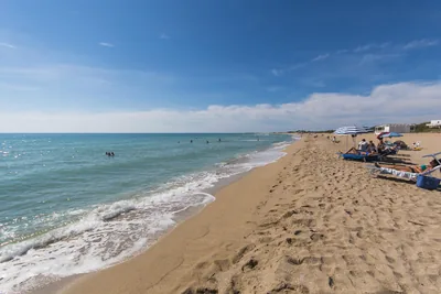 Sea and cavesMarina di PescoluseWith its fine golden sand and the crystal clear water, the beach of
Pescoluse is the envy of the exotic destinations overseas. Salve 1.7 km away
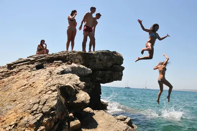 Sea and cavesSan GregorioSan Gregorio, with its unspoiled sea beds, the blue sea and the rocky
coast, offers an wonderful view along the coastline of Patù. Patù 3.1 km away
Beaches nearby
- Rocks and cliffsSan GregorioInlet with a small pier and a bay of large pebbles among low rocks, waters for mask and snorkel and the ancient Messapian port of Vereto.Free · 1 beach club Excellent water Natura 2000 Patù · Ionian 2.8 km away
- SandMarina di FellonicheSeaside spot between Leuca and San Gregorio: low rocky shore with a sandy stretch of about 300 metres, almost all free.Free · beach clubs Excellent water Natura 2000 Castrignano del Capo · Ionian 3.6 km away
- SandPescoluse – Maldive del SalentoLong beach of very fine pale sand with dunes, shallow water, free stretches and many beach clubs, from Posto Vecchio to Pescoluse.Free · 13 beach clubs Excellent water Blue Flag town Salve · Ionian 3.6 km away
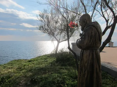 MixedPunta RistolaCoast of rocks and cliffs from Punta Ristola towards Torre Marchiello, with pale rock and sea caves: no sand and no beach clubs.Free Excellent water Natura 2000 Castrignano del Capo · Ionian 6.1 km away
Sources and licences
The data comes from public sources; before swimming check the signs and the town’s bathing ordinances.
- ARPA Puglia – Monitoraggio delle acque di balneazione (CC BY 4.0)
- Regione Puglia – Aree di balneazione e classificazione 2024 (CC BY 4.0)
- Regione Puglia – Piano Regionale delle Coste (SIT Puglia) (CC BY 4.0)
- © OpenStreetMap contributors (ODbL 1.0)
- Regione Puglia – Ricognizione dei Piani comunali delle coste (A.D. 142/2025, SIT Puglia) (CC BY 4.0)
- Wikimedia Commons (foto: autore e licenza su ogni foto) (CC0, PD, CC BY, CC BY-SA)
- salentosagreeventi.it – luoghi (foto e testi già pubblicati) (come indicato sulle foto)
- FEE Italia – Bandiera Blu 2026 (dato pubblico (elenco dei comuni premiati))
- Wind forecast: MET Norway (CC BY 4.0).
- Photos: Franco Cappellari · Regione Puglia
- Photos: Lupiae, CC BY-SA 3.0 · Wikimedia Commons
- Photos: Regione Puglia, CC BY-SA 3.0 IT · Wikimedia Commons
- Photos: Patrick Nouhailler's…, CC BY-SA 3.0 · Wikimedia Commons
- Photos: Patrick Nouhailler's…, CC BY-SA 3.0 · Wikimedia Commons
- Photos: Patrick Nouhailler's…, CC BY-SA 3.0 · Wikimedia Commons
- Photos: Patrick Nouhailler's…, CC BY-SA 3.0 · Wikimedia Commons
- Photos: Luca Margheriti, CC BY-SA 3.0 · Wikimedia Commons
- Data updated: Sunday, 25 October 2026.