
Rocks and cliffs Blue Flag town Excellent water Protected area
Castro Marina
Castro (LE)· Sea: Adriatic
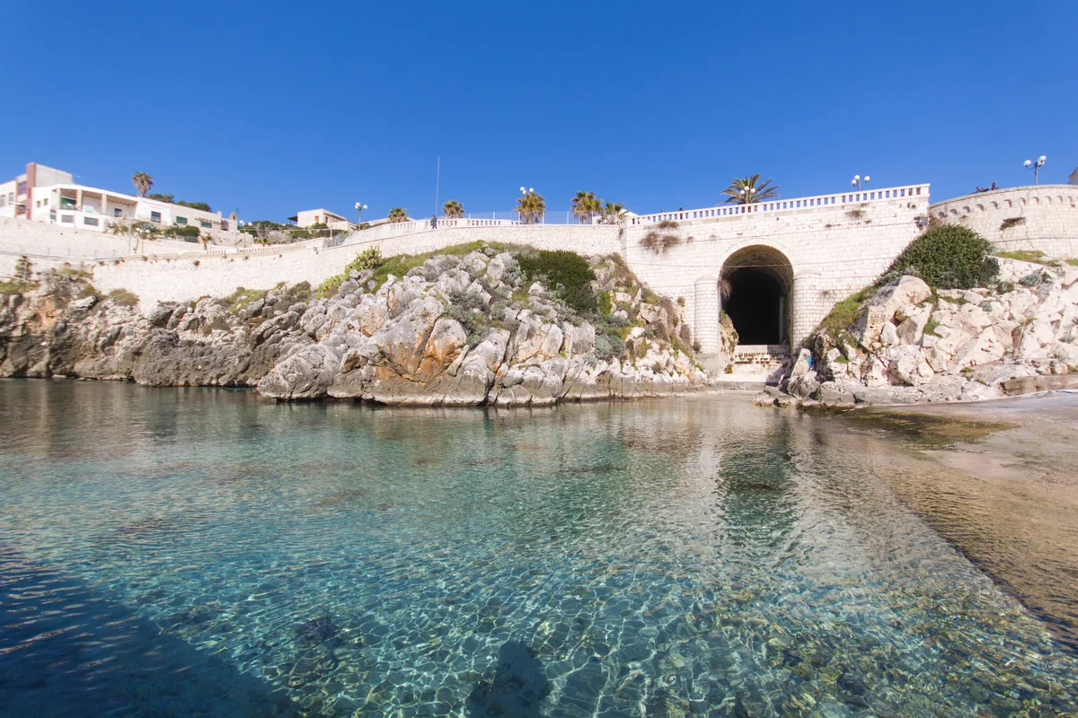
The beach at a glance
Rocky shores to dive from into a sea ranging from green to blue, between the harbour, the Grotta Zinzulusa and the Sorgente.
- Type of coast
- Rocks and cliffs
- Rocks 5,792 m
- Cliff 159 m
- Man-made 108 m
- Length
- 6,059 m
- Seafront
- 392 m free184 m leased to beach clubs
- Water quality
- Excellent · classification 2024
- Off season: latest samples of the 2026 season
- ARPA bathing areas:
- GROTTA ROMANELLIExcellentWed 8 Jul: within limits
- GROTTA ZINZULUSAExcellentWed 8 Jul: within limits
- LA SORGENTEExcellentWed 8 Jul: within limits
- Blue Flag town
- Castro has the Blue Flag this year
- Protected area
- Parco naturale regionale Costa Otranto-S.Maria di Leuca e Bosco di Tricase
- Natura 2000 network
- ZSC Costa Otranto - Santa Maria di Leuca (IT9150002)
About the beach
Castro Marina is a six-kilometre stretch of rocky shore, from the Grotta Romanelli to the Zinzulusa, the harbour and the La Sorgente area. There is no sand: you get into the water from the rocks, in a sea that ranges from aquamarine to deep blue. A beach club takes up a good part of the bay, but next to it there are still free rocks, and the concrete platform behind the marina is a very popular diving spot. You will need water shoes.
From the harbour boats leave for the caves along the coast, such as the Grotta Palombara and the Grotta Azzurra; the Zinzulusa, with stalactites that popular imagination likened to rags, the 'zinzuli', can also be reached from land. Up above, the village of Castro, heir to ancient Castrum Minervae, preserves its Aragonese castle and cathedral. The coast is in the Costa Otranto-Santa Maria di Leuca e Bosco di Tricase regional nature park. It is part of the Costa Otranto - Santa Maria di Leuca Natura 2000 site.
The car parks are close to the harbour. The bay is sheltered from the north (tramontana) and west (ponente) winds, and also from the south (ostro), south-west (libeccio) and north-west (maestrale) winds; with north-east (grecale), east (levante) and south-east (scirocco) winds the sea gets rough. Castro is a Blue Flag municipality.
On the map
Stretch of beachBeach club
Beach clubs
On this stretch of beach or less than 300 m away.
Lido La Sorgente
Events nearby
In the coming days within 5 km.
San Vito Fair and Pig Festival
Celebrating the pig in Ortelle, combining gastronomic tradition and local crafts in a festive gathering.
Things to see nearby
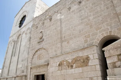 Churches and cryptsCathedral of CastroIn the characteristic town of Castro, the splendid medieval Cathedral
stands on the ruins of an ancient Greek temple. Castro very close
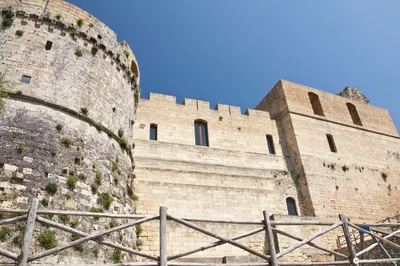 Castles, towers and palacesCastle of CastroThe Castle of Castro used to be a fortress with the strategic function of
protecting the coast and it tells about the splendour of the past. Castro very close
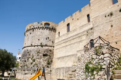 Museums and theatresCivic Museum “Antonio Lazzari”Castro's Aragonese Castle houses the Civic Museum named after speleologist
Antonio Lazzari, where an archaeological collection can be admired. Castro very close
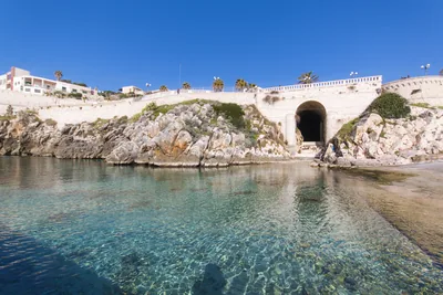 Sea and cavesCastro MarinaFrom the “zinzuli” (shreds) of the marine caves, as far as the beautiful
cliffs from which it is possible to dive in the water: Castro Marina is a
blue paradise overlooking the Adriatic sea. Castro very close
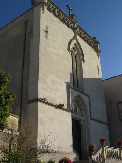 Churches and cryptsSantuario Madonna del Rosario di PompeiSanctuary of the nineteenth century also known as Beata Vergine del
Rosario, located in the heart of Castro Marina. Castro very close
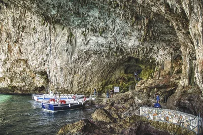 Sea and cavesZinzulusa CaveThe spectacular karstic cave known as the Zinzulusa Cave extends beneath an
inlet south of Castro. Castro very close
Beaches nearby
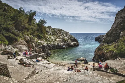 Rocks and cliffsCala dell'AcquavivaNarrow fjord between the rocks ending in a small free bay, with ice-cold freshwater springs, at Marina di Marittima.Free Excellent water Protected area Diso · Adriatic 2.4 km away
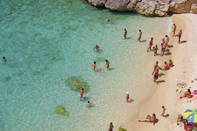 Rocks and cliffsPorto MiggianoSmall cove between twenty-metre cliffs, reached by about a hundred steps, below the 16th-century tower.Free Excellent water Protected area Santa Cesarea Terme · Adriatic 3 km away
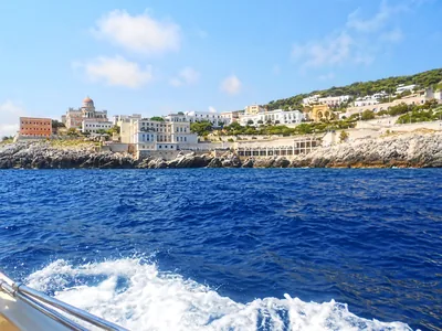 Rocks and cliffsSanta Cesarea TermeSheer rocky shore with steps, natural pools in old quarries and sulphurous thermal waters, below the town's villas.2 beach clubs Excellent water Natura 2000 Santa Cesarea Terme · Adriatic 3.9 km away
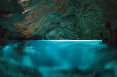 Rocks and cliffsMarina di AndranoRocky shores and small ways into the sea along the lungomare delle Agavi, from the small harbour to the Botte, with the Grotta Verde.Free · 2 beach clubs Excellent water Protected area Andrano · Adriatic 4.4 km away
Sources and licences
The data comes from public sources; before swimming check the signs and the town’s bathing ordinances.
- ARPA Puglia – Monitoraggio delle acque di balneazione (CC BY 4.0)
- Regione Puglia – Aree di balneazione e classificazione 2024 (CC BY 4.0)
- Regione Puglia – Piano Regionale delle Coste (SIT Puglia) (CC BY 4.0)
- © OpenStreetMap contributors (ODbL 1.0)
- Regione Puglia – Ricognizione dei Piani comunali delle coste (A.D. 142/2025, SIT Puglia) (CC BY 4.0)
- Regione Puglia – Parchi e riserve naturali (rev. 11/2022) (CC BY 4.0)
- Regione Puglia – Perimetrazione dei siti Natura 2000 (12/2023) (CC BY 4.0)
- Wikimedia Commons (foto: autore e licenza su ogni foto) (CC0, PD, CC BY, CC BY-SA)
- salentosagreeventi.it – luoghi (foto e testi già pubblicati) (come indicato sulle foto)
- FEE Italia – Bandiera Blu 2026 (dato pubblico (elenco dei comuni premiati))
- Wind forecast: MET Norway (CC BY 4.0).
- Photos: Paolo Laku · Regione Puglia
- Photos: Leonardo D'Angelo · Regione Puglia
- Photos: Holger Uwe Schmitt, CC BY-SA 4.0 · Wikimedia Commons
- Photos: Shaw at Italian Wikipedia, CC BY-SA 3.0 · Wikimedia Commons
- Photos: Holger Uwe Schmitt, CC BY-SA 4.0 · Wikimedia Commons
- Photos: Holger Uwe Schmitt, CC BY-SA 4.0 · Wikimedia Commons
- Photos: Holger Uwe Schmitt, CC BY-SA 4.0 · Wikimedia Commons
- Photos: Holger Uwe Schmitt, CC BY-SA 4.0 · Wikimedia Commons
- Photos: Holger Uwe Schmitt, CC BY-SA 4.0 · Wikimedia Commons
- Photos: Holger Uwe Schmitt, CC BY-SA 4.0 · Wikimedia Commons
- Data updated: Sunday, 25 October 2026.