
Rocks and cliffs Excellent water Protected areaFor families
Marina di Andrano
Andrano (LE)· Sea: Adriatic
The beach at a glance
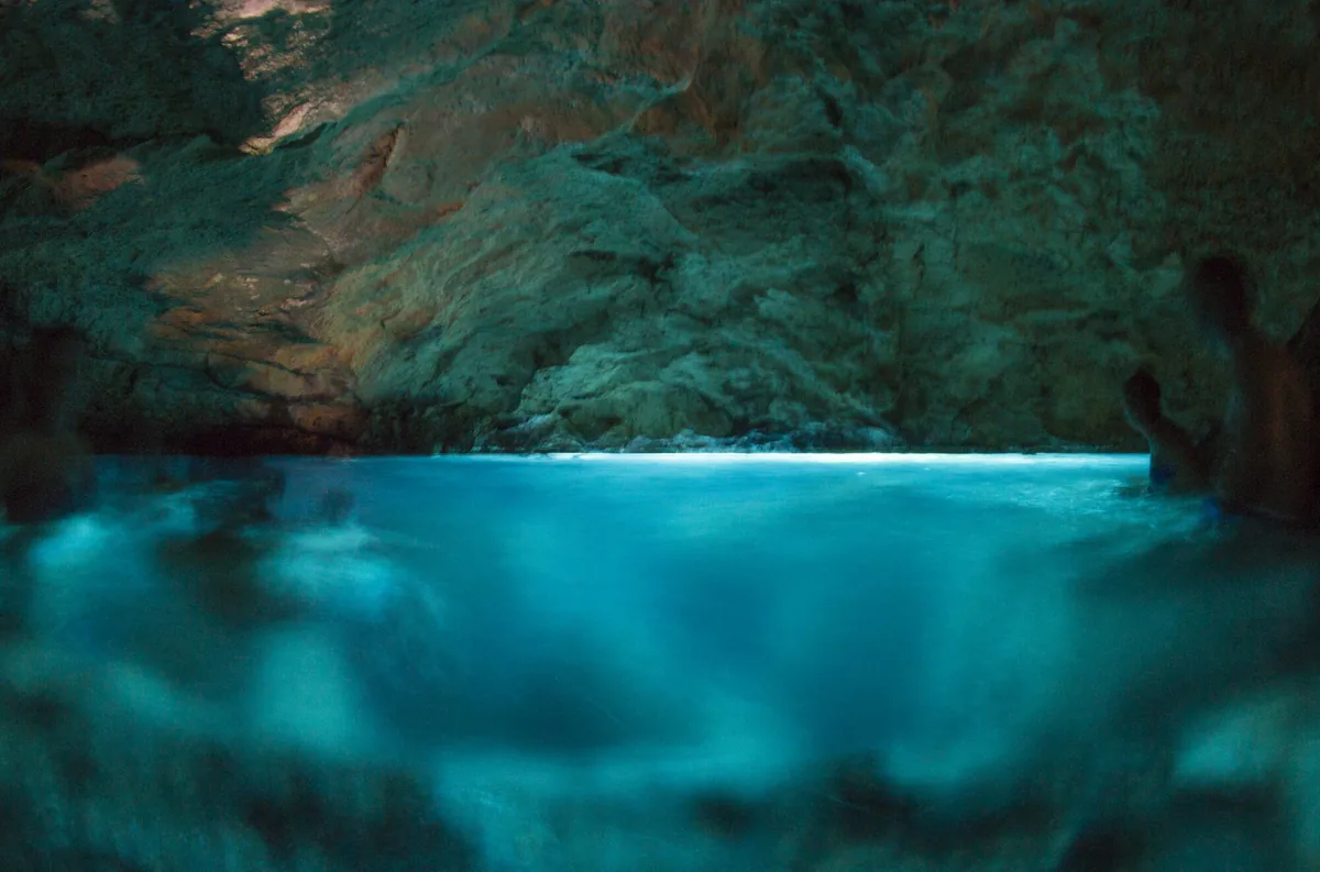
Rocky shores and small ways into the sea along the lungomare delle Agavi, from the small harbour to the Botte, with the Grotta Verde.
- Type of coast
- Rocks and cliffs
- Rocks 3,762 m
- Length
- 3,762 m
- Seafront
- 61% free
- 652 m free415 m leased to beach clubs
- Water quality
- Excellent · classification 2024
- Off season: latest samples of the 2026 season
- ARPA bathing areas:
- INGRESSO DEL PORTICCIOLOExcellentThu 9 Jul: within limits
- LA BOTTEExcellentThu 9 Jul: within limits
- Protected area
- Parco naturale regionale Costa Otranto-S.Maria di Leuca e Bosco di Tricase
- Natura 2000 network
- ZSC Costa Otranto - Santa Maria di Leuca (IT9150002)
About the beach
Marina di Andrano is a stretch of rocky shore almost four kilometres long, from the small harbour cut into the rock, in the north, to the Botte. Rocks alternate with small, easy ways into the sea, linked by the lungomare delle Agavi, a fully pedestrian seafront promenade. There are two beach clubs, on the rock, and one is wheelchair accessible; the rest of the rocks are free.
Families choose the Botte, with shallow water suitable for children to play. At Marina della Torre there are two swimming spots: the Fiume, so called because of a freshwater spring, and the Grotta Verde, which fills with emerald reflections in the sunlight. In the village the old cistern of the 16th-century Torre Porto di Ripa remains, and from the Madonna dell'Attarico viewpoint you can enjoy the panorama. On the rocks you will need water shoes. It is part of the Costa Otranto - Santa Maria di Leuca Natura 2000 site.
The car parks are close by. The coast faces east: with north (tramontana), south (ostro), south-west (libeccio), west (ponente) and north-west (maestrale) winds it is sheltered, with north-east (grecale), east (levante) and south-east (scirocco) winds the sea gets rough.
On the map
Stretch of beachBeach club
Beach clubs
On this stretch of beach or less than 300 m away.
Lido Alborhé
- Services for people with disabilities: carrozzine
- Parking
Swim Liberi di Nuotare
- Services for people with disabilities: accessibile in carrozzina
Events nearby
In the coming days within 5 km.
No events within 5 km in the coming days.
Things to see nearby
 Sea and cavesMarina di AndranoAlong the Agavi promenade, in Marina di Andrano, appears the green emerald
Grotta Verde and the cliffs in the localities Fiume and La Botte. Andrano very close
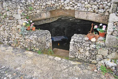 Churches and cryptsThe Crypt of the Madonna dell’AttaricoNestled among olive trees, the crypt of the Madonna dell’Attarico di
Andrano still show traces of frescoes and its Basilian past. Andrano very close
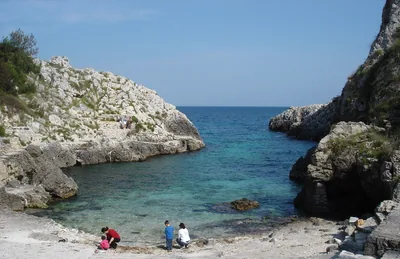 Sea and cavesMarina di MarittimaAmid picturesque coves and smoothed cliffs, Marina di Marittima is lapped
by the blue and clear sea. Diso 2.3 km away
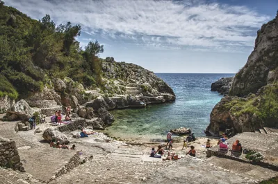 Sea and cavesCala dell'AcquavivaThe Acquaviva channel, with its cold water springs and small bays with
pebbles, flows amid the rocks and the lush vegetation. Diso 2.3 km away
- Castles, towers and palacesBaldassarra Tower, Alfonso Tower, Colombaia Tower and Lupo TowerDating back to the 16th century, the four towers are a landmark in the history of Marittima. Diso 2.9 km away
Beaches nearby
- Rocks and cliffsCala dell'AcquavivaNarrow fjord between the rocks ending in a small free bay, with ice-cold freshwater springs, at Marina di Marittima.Free Excellent water Protected area Diso · Adriatic 2.1 km away
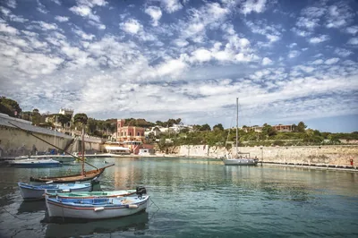 Rocks and cliffsTricase PortoLow rocky coast with caves and coves, two small harbours and an islet a few strokes away, from the Serra del Mito to San Nicola.Free Excellent water Blue Flag town Protected area Tricase · Adriatic 3.6 km away
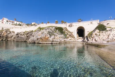 Rocks and cliffsCastro MarinaRocky shores to dive from into a sea ranging from green to blue, between the harbour, the Grotta Zinzulusa and the Sorgente.1 beach club Excellent water Blue Flag town Protected area Castro · Adriatic 4.4 km away
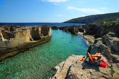 Rocks and cliffsMarina SerraWild rocky shore with a shallow natural pool, below the Torre di Palàne, as far as Torre Nasparo.Free Excellent water Blue Flag town Protected area Tricase · Adriatic 7.2 km away
Sources and licences
The data comes from public sources; before swimming check the signs and the town’s bathing ordinances.
- ARPA Puglia – Monitoraggio delle acque di balneazione (CC BY 4.0)
- Regione Puglia – Aree di balneazione e classificazione 2024 (CC BY 4.0)
- Regione Puglia – Piano Regionale delle Coste (SIT Puglia) (CC BY 4.0)
- © OpenStreetMap contributors (ODbL 1.0)
- Regione Puglia – Ricognizione dei Piani comunali delle coste (A.D. 142/2025, SIT Puglia) (CC BY 4.0)
- Regione Puglia – Parchi e riserve naturali (rev. 11/2022) (CC BY 4.0)
- Regione Puglia – Perimetrazione dei siti Natura 2000 (12/2023) (CC BY 4.0)
- Pugliapromozione – DMS Puglia, open data (stabilimenti balneari, luoghi di interesse) (CC BY 4.0)
- salentosagreeventi.it – luoghi (foto e testi già pubblicati) (come indicato sulle foto)
- Wind forecast: MET Norway (CC BY 4.0).
- Photos: Paolo Laku · Regione Puglia
- Data updated: Sunday, 25 October 2026.