
Rocks and cliffs Blue Flag town Excellent water Protected areaFor families
Tricase Porto
Tricase (LE)· Sea: Adriatic
The beach at a glance
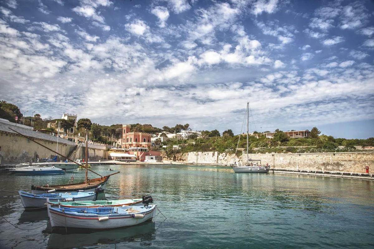
Low rocky coast with caves and coves, two small harbours and an islet a few strokes away, from the Serra del Mito to San Nicola.
- Type of coast
- Rocks and cliffs
- Rocks 5,254 m
- Man-made 101 m
- Length
- 5,355 m
- Seafront
- 194 m free0 m leased to beach clubs
- Water quality
- Excellent · classification 2024
- Off season: latest samples of the 2026 season
- ARPA bathing areas:
- SERRA DEL MITOExcellentThu 9 Jul: within limits
- 500 MT SUD PUNTO 68ExcellentThu 9 Jul: within limits
- Blue Flag town
- Tricase has the Blue Flag this year
- Protected area
- Parco naturale regionale Costa Otranto-S.Maria di Leuca e Bosco di Tricase
- Natura 2000 network
- ZSC Costa Otranto - Santa Maria di Leuca (IT9150002)
- ZSC Bosco Guarini (IT9150001)
About the beach
Tricase Porto is a small village on the last spurs of the Salento's low ridges. The stretch also includes the Serra del Mito, north of the harbour, overlooked by the Torre del Sasso 116 metres above the sea: over five kilometres of low, rocky coast, with caves and small free inlets. There are no beach clubs; alongside the natural coves there are two small harbours, one old and one modern, from which boats set out.
Just north of the village, following the 'passeggio degli dei' (walk of the gods), is the Isola, an islet you can reach in a few strokes and loved by children; the low rocks slope gently into the water. Towards Leuca is the Canale del Rio, at the bottom of which, according to legend, lie the bells of a church built by the devil in a single night. The coast is in the Costa Otranto-Santa Maria di Leuca e Bosco di Tricase regional nature park. It is part of the Costa Otranto - Santa Maria di Leuca and Bosco Guarini Natura 2000 sites.
The car parks are close to the harbour. The coast faces east: with north (tramontana), south (ostro), south-west (libeccio), west (ponente) and north-west (maestrale) winds it is sheltered, with north-east (grecale), east (levante) and south-east (scirocco) winds the sea gets rough. Tricase is a Blue Flag municipality.
On the map
Stretch of beach
Events nearby
In the coming days within 5 km.
Yuts And Culture
Yuts and Culture in concert: funk and soul of the '70s reimagined.
Tricase Nobilissima
A guided tour through Palazzo Gallone, the Matrice Church, and the ancient streets of Tricase
Salento International Film Festival 2026
International independent cinema in the heart of Salento
Things to see nearby
 Sea and cavesPorticciolo di Marina di Porto - TricaseThe Marina di Porto harbor in Tricase features a surfaced, banked-out mooring, a banked-out section of shoreline and an internal dock. Tricase very close
- Museums and theatresThe permanent cultural centre on sea ancient traditionsFounded and run by the association Magna Grecia Mare, is the centre of many cultural initiatives. Tricase very close
- Museums and theatresThe Museum of Sea Traditional Boats and Sea ArtDynamic museum, full of training programmes, laboratories and practical experiences, it is located in the Casotto of the Port of Tricase. Tricase very close
 Sea and cavesTricase PortoTricase Porto, with its caves and small bays, the small island and the
beautiful cliffs, is the perfect place to discover by boat the coastline of
Capo di Leuca. Tricase 1 km away
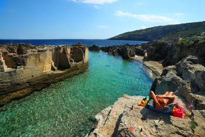 Sea and cavesMarina SerraMarina Serra, surrounded by cliffs, marine caves and small fjords, boasts a
natural pool nestled amid the rocks, with crystal clear water. Tricase 2.8 km away
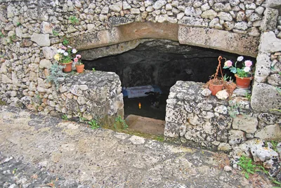 Churches and cryptsThe Crypt of the Madonna dell’AttaricoNestled among olive trees, the crypt of the Madonna dell’Attarico di
Andrano still show traces of frescoes and its Basilian past. Andrano 3.3 km away
Beaches nearby
- Rocks and cliffsMarina SerraWild rocky shore with a shallow natural pool, below the Torre di Palàne, as far as Torre Nasparo.Free Excellent water Blue Flag town Protected area Tricase · Adriatic 3.6 km away
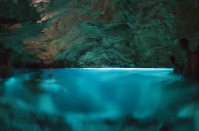 Rocks and cliffsMarina di AndranoRocky shores and small ways into the sea along the lungomare delle Agavi, from the small harbour to the Botte, with the Grotta Verde.Free · 2 beach clubs Excellent water Protected area Andrano · Adriatic 3.6 km away
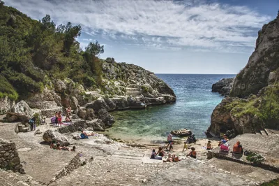 Rocks and cliffsCala dell'AcquavivaNarrow fjord between the rocks ending in a small free bay, with ice-cold freshwater springs, at Marina di Marittima.Free Excellent water Protected area Diso · Adriatic 5.7 km away
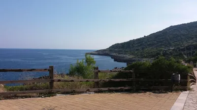 Rocks and cliffsFunnovojereRugged rocky shore of Corsano with old salt pans in the rock, terraces of vines and olives and easy access at Chineddi and Sprunu.Free Excellent water Protected area Corsano · Adriatic 5.8 km away
Sources and licences
The data comes from public sources; before swimming check the signs and the town’s bathing ordinances.
- ARPA Puglia – Monitoraggio delle acque di balneazione (CC BY 4.0)
- Regione Puglia – Aree di balneazione e classificazione 2024 (CC BY 4.0)
- Regione Puglia – Piano Regionale delle Coste (SIT Puglia) (CC BY 4.0)
- © OpenStreetMap contributors (ODbL 1.0)
- Regione Puglia – Ricognizione dei Piani comunali delle coste (A.D. 142/2025, SIT Puglia) (CC BY 4.0)
- Regione Puglia – Parchi e riserve naturali (rev. 11/2022) (CC BY 4.0)
- Regione Puglia – Perimetrazione dei siti Natura 2000 (12/2023) (CC BY 4.0)
- Wikimedia Commons (foto: autore e licenza su ogni foto) (CC0, PD, CC BY, CC BY-SA)
- salentosagreeventi.it – luoghi (foto e testi già pubblicati) (come indicato sulle foto)
- FEE Italia – Bandiera Blu 2026 (dato pubblico (elenco dei comuni premiati))
- Wind forecast: MET Norway (CC BY 4.0).
- Photos: Leonardo D'Angelo · Regione Puglia
- Photos: Alexsant2022, CC BY-SA 4.0 · Wikimedia Commons
- Photos: Patrick Nouhailler's…, CC BY-SA 3.0 · Wikimedia Commons
- Photos: Patrick Nouhailler's…, CC BY-SA 3.0 · Wikimedia Commons
- Photos: Davide Mauro, CC BY-SA 4.0 · Wikimedia Commons
- Photos: Davide Mauro, CC BY-SA 4.0 · Wikimedia Commons
- Photos: Michael Paraskevas, CC BY-SA 3.0 · Wikimedia Commons
- Data updated: Sunday, 25 October 2026.