
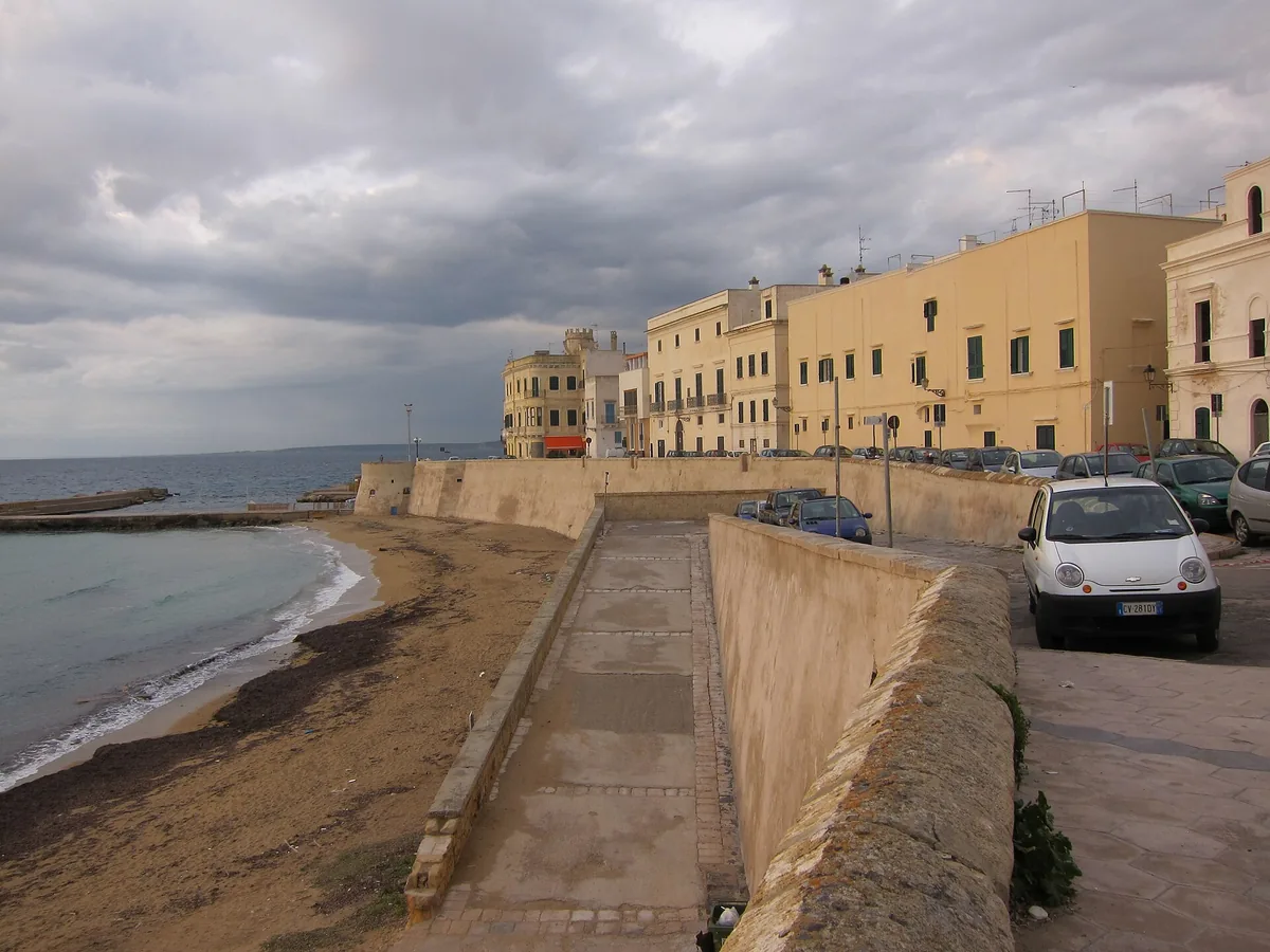
The beach at a glance
Short stretch of low rocky shore between Baia Verde and the port of Gallipoli, right by the seafront and the town.
- Type of coast
- Rocks and cliffs
- Rocks 1,371 m
- Length
- 1,371 m
- Seafront
- 180 m free0 m leased to beach clubs
- Water quality
- Excellent · classification 2024
- Off season: latest samples of the 2026 season
- ARPA bathing areas:
- SPIAGGIA LIDO PICCOLOExcellentTue 14 Jul: within limits
- CEDUC 500 MT NORD P.P.106ExcellentTue 14 Jul: within limits
- Blue Flag town
- Gallipoli has the Blue Flag this year
About the beach
This stretch of coast, just under one and a half kilometres, runs between Baia Verde and the port of Gallipoli, as far as Cala Fontanelle. It is all low rocky shore, with no sandy beach: you get into the water from the rocks, with water shoes, and there is only one beach club.
You swim practically in town. Behind runs the lungomare Galilei, the evening promenade of locals and visitors, with bars and venues; to the north you come to Cala Fontanelle, with a boatyard and the fishermen's boats, the dock and then the commercial port. Less than a kilometre away is the historic centre on the island, with the castle surrounded by the sea, the sanctuary of Santa Maria del Canneto and the Fontana greca; on the other side, towards Baia Verde, is the San Giovanni la Pedata tower.
There are plenty of car parks, the first a few steps away. Gallipoli is a Blue Flag municipality. The coast faces south-west: with north (tramontana), north-east (grecale), east (levante), south-east (scirocco) and north-west (maestrale) winds the sea is calm, with south (ostro), south-west (libeccio) and west (ponente) winds it gets rough.
On the map
Stretch of beachBeach club
Beach clubs
On this stretch of beach or less than 300 m away.
Lido San Giovanni
Bar · Quotidiani · Ristorante · Punto ristoro
- Services for people with disabilities: sedia JOB
- Parking
Events nearby
In the coming days within 5 km.

Halloween vs Dia de los Muertos
Night of celebration with three stages, music, and thematic scenery.

Valentina Persia - Nata con la Guêpière
Humor and personal storytelling for a theatrical evening.
AI on Trial
Reflection and debate on artificial intelligence in Gallipoli.
Canto Libero - Tribute to the Songs of Battisti and Mogol
Things to see nearby
- FunLungomare GalileiThe Galilei Promenade runs along the entire northwest side of the city and in summer is the evening promenade for tourists and Gallipolians alike. Gallipoli very close
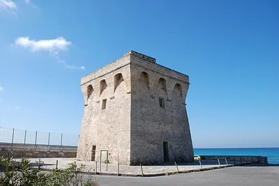 Castles, towers and palacesTorre San Giovanni La PedataBuilt in the 16th century, it immediately served to defend the coastline. Gallipoli very close
- Sea and cavesCala FontanelleCala Fontanelle is a public landing spot south of Darsena Fontanelle, with a shipyard equipped with a slipway. Gallipoli 1.1 km away
- Sea and cavesDarsena FontanelleThe Fontanelle marina is private and reserved for mooring. Gallipoli 1.1 km away
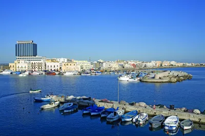 Sea and cavesGallipoli Commercial PortThe commercial port of Gallipoli is located north of the old town, bounded by the outer mole to the north and a submerged mole to the east. Gallipoli 1.2 km away
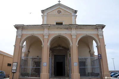 Churches and cryptsSantuario di Santa Maria del CannetoThe Baroque sanctuary is mirrored in the waters of Ionian Sea and blesses
the Gallipoli fishers, who look upon the church while sailing. Gallipoli 1.3 km away
Beaches nearby
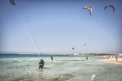 SandBaia VerdeLong beach of fine white sand south of Gallipoli, among dunes and many beach clubs, with shallow water near the shore.Free · 17 beach clubs Excellent water Blue Flag town Natura 2000 Gallipoli · Ionian 2.4 km away
- Rocks and cliffsTorre SabeaShort stretch of low rocks north of Gallipoli, below the small 16th-century tower in the Crocefisso area.Beach clubs Excellent water Blue Flag town Gallipoli · Ionian 2.9 km away
- MixedRivabellaSandy beach north of Gallipoli with stretches of low rocks, largely free and with a few beach clubs.Free · 6 beach clubs Excellent water Blue Flag town Gallipoli · Ionian 4 km away
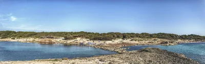 Rocks and cliffsPunta della SuinaTwo small sandy bays among low dunes, pine wood and rocks, facing the Scoglio Tondo, in the Punta Pizzo park.Free · 2 beach clubs Excellent water Blue Flag town Protected area Gallipoli · Ionian 5.2 km away
Sources and licences
The data comes from public sources; before swimming check the signs and the town’s bathing ordinances.
- ARPA Puglia – Monitoraggio delle acque di balneazione (CC BY 4.0)
- Regione Puglia – Aree di balneazione e classificazione 2024 (CC BY 4.0)
- Regione Puglia – Piano Regionale delle Coste (SIT Puglia) (CC BY 4.0)
- © OpenStreetMap contributors (ODbL 1.0)
- Regione Puglia – Ricognizione dei Piani comunali delle coste (A.D. 142/2025, SIT Puglia) (CC BY 4.0)
- Pugliapromozione – DMS Puglia, open data (stabilimenti balneari, luoghi di interesse) (CC BY 4.0)
- Wikimedia Commons (foto: autore e licenza su ogni foto) (CC0, PD, CC BY, CC BY-SA)
- FEE Italia – Bandiera Blu 2026 (dato pubblico (elenco dei comuni premiati))
- Wind forecast: MET Norway (CC BY 4.0).
- Photos: Art Anderson, CC BY-SA 3.0 · Wikimedia Commons
- Photos: Luca Margheriti, CC BY-SA 3.0 · Wikimedia Commons
- Photos: Luca Margheriti, CC BY-SA 3.0 · Wikimedia Commons
- Photos: Ainars Brūvelis, CC BY-SA 3.0 · Wikimedia Commons
- Data updated: Sunday, 25 October 2026.