
The beach at a glance
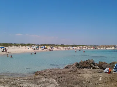
Long sandy beach from the Apani rock towards Brindisi, with many beach clubs and a few free stretches.
- Type of coast
- Sand
- Sand 886 m
- Rocks 295 m
- Length
- 1,289 m
- Seafront
- 30% free
- 328 m free753 m leased to beach clubs
- Water quality
- Excellent · classification 2024
- Off season: latest samples of the 2026 season
- ARPA bathing areas:
- DI FRONTE ALLO SCOGLIO DI APANIExcellentMon 13 Jul: within limits
- APANI LIDO S VINCENZOExcellentMon 13 Jul: within limits
- APANI LIDO AZZURROExcellentMon 13 Jul: within limits
- APANI LIDO ARCA DI NOE'ExcellentMon 13 Jul: within limits
1 more areas
- APANI LIDO S LUCIAExcellentMon 13 Jul: within limits
- Protected area
- Riserva naturale marina Torre Guaceto
- Coastal erosion
- medium
About the beach
Apani is the long sandy beach that starts from the Apani rock, which falls within the Torre Guaceto marine protected area, and runs down towards Brindisi. It is about one kilometre and three hundred metres long, sandy almost everywhere, with a few stretches of low rocks. The beachfront is taken up mainly by beach clubs, six in all, some with reserved parking for people with disabilities; the free stretches are shorter.
To the north begins the Torre Guaceto reserve, with dunes, scrub and the tower on the headland. Inland, about a kilometre from the sea, is Torre Regina Giovanna, in tufo with crenellated battlements, perhaps built to communicate by sight with the castle of Serranova.
The car parks are close to the sea. The sandy seabed is suitable for families, and the coast is subject to erosion. The beach faces north: north (tramontana), north-east (grecale) and north-west (maestrale) winds make the sea rough, while with east (levante), south-east (scirocco), south (ostro), south-west (libeccio) and west (ponente) winds it is sheltered.
On the map
Stretch of beachBeach club
Beach clubs
On this stretch of beach or less than 300 m away.
Events nearby
In the coming days within 5 km.
No events within 5 km in the coming days.
Things to see nearby
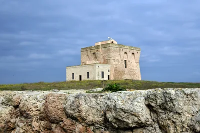
- Nature and gardensFoce Canale GiancolaGiancola, a natural channel whose origin is due to the erosive action, is surrounded by small lakes, marsh reeds and scented Mediterranean scrub. Brindisi 3.6 km away
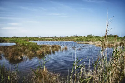
 Sea and cavesTelematic Mooring Field of Torre GuacetoAn innovative telematic mooring system allowing access to the enchanting Torre Guaceto Marine Protected Area. Carovigno 3.7 km away
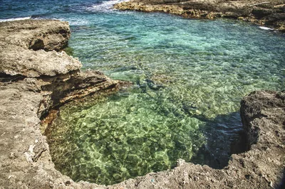
 Nature and gardensState Nature Reserve of Torre GuacetoThe Reserve of Torre Guaceto, amid hundred-years old olive trees, dunes and
marshes, await for visitors for educational activities and hikes or bike
tours through the paths surrounded by green. Carovigno 4.1 km away
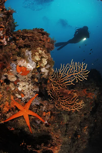
 Sea and cavesTorre GuacetoA natural paradise, made of sandy coves, clear water and expanses of
Posidonia Oceanica, Torre Guaceto welcomes visitors in the shade of an
Aragonese watchtower, for a relaxing and sport holiday. Carovigno 4.2 km away
 Sea and cavesTorre Guaceto Protected Marine AreaOverlooked by centuries-old coastal watchtowers, the cliffs and sandy
beaches of the Protected Marine Area of Torre Guaceto extend along the
Adriatic coast from Punta Penna Grossa to the cliffs of Apani. Carovigno 4.2 km away
Beaches nearby
- SandTorre TestaSandy beach north of Brindisi, near the mouth of the Canale Giancola and the Torre Testa watchtower.Beach clubs Excellent water Natura 2000 Brindisi · Adriatic 3.2 km away
- SandTorre GuacetoBay below the tower of Guaceto and a free beach as far as the Canale Reale, in the heart of the marine protected area.Free Excellent water Blue Flag town Protected area Carovigno, Brindisi · Adriatic 4.2 km away
 SandPunta Penna GrossaLong beach of fine sand among dunes and junipers at the start of the Torre Guaceto reserve, almost entirely free.Free · 1 beach club Excellent water Blue Flag town Protected area Carovigno · Adriatic 5.2 km away
- PebblesSbitriPebble and sand beach north of Brindisi, between the mouth of the Canale Giancola and Sciaia, with free stretches.Free · 2 beach clubs Excellent water Brindisi · Adriatic 5.6 km away
Sources and licences
The data comes from public sources; before swimming check the signs and the town’s bathing ordinances.
- ARPA Puglia – Monitoraggio delle acque di balneazione (CC BY 4.0)
- Regione Puglia – Aree di balneazione e classificazione 2024 (CC BY 4.0)
- Regione Puglia – Piano Regionale delle Coste (SIT Puglia) (CC BY 4.0)
- © OpenStreetMap contributors (ODbL 1.0)
- Regione Puglia – Ricognizione dei Piani comunali delle coste (A.D. 142/2025, SIT Puglia) (CC BY 4.0)
- Regione Puglia – Parchi e riserve naturali (rev. 11/2022) (CC BY 4.0)
- Pugliapromozione – DMS Puglia, open data (stabilimenti balneari, luoghi di interesse) (CC BY 4.0)
- Wind forecast: MET Norway (CC BY 4.0).
- Data updated: Sunday, 25 October 2026.