
The beach at a glance
Pebble and sand beach north of Brindisi, between the mouth of the Canale Giancola and Sciaia, with free stretches.
- Type of coast
- Pebbles
- Sand 435 m
- Pebbles 681 m
- Cliff 372 m
- Man-made 171 m
- Length
- 1,671 m
- Seafront
- 79% free
- 1,075 m free289 m leased to beach clubs
- Water quality
- Excellent · classification 2024
- Off season: latest samples of the 2026 season
- ARPA bathing areas:
- SBITRI LIDO S ANNAExcellentMon 13 Jul: within limits
- SBITRI VECCHIO LIDO ACQUE CHIAREExcellentMon 13 Jul: within limits
- SBITRI - SCARICO I.A.M. 200 MT. NORDExcellentMon 13 Jul: within limits
About the beach
Sbitri, also called Case Bianche, is a beach on the northern coast of Brindisi made up mostly of pebbles, with some sandy stretches and a section of high coast; the whole stretch is about one kilometre and seven hundred metres long. The beachfront is mostly free, with two beach clubs.
It lies between the mouth of the Canale Giancola, a special area of conservation with a reed bed and sandstone walls covered in scrub, and the low rocky shore of Sciaia, where small sandy coves open between the rocks and anglers take up their spots along the shore. To the south the coast continues as far as Punta Penne.
The nearest car park is a few hundred metres away. On the pebbles water shoes help, both for walking and for getting into the water. According to the data the beach is also suitable for families. It faces north: north (tramontana), north-east (grecale) and north-west (maestrale) winds make the sea rough, while with east (levante), south-east (scirocco), south (ostro), south-west (libeccio) and west (ponente) winds it stays calm.
On the map
Stretch of beachBeach club
Beach clubs
On this stretch of beach or less than 300 m away.
Beach one
Lido Sant'Anna
Events nearby
In the coming days within 5 km.
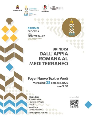
Brindisi: From the Roman Appia to the Mediterranean
Conference on the Via Appia-Traiana and Brindisi's role in the ancient Mediterranean.
Things to see nearby
- Sea and cavesSciai -former Pic NicThe rocky and jagged coastline of Sciaia – Former Pic Nic overlooks the Adriatic Sea, not far away from the tourist port of Brindisi. Brindisi 1.8 km away
- Nature and gardensFoce Canale GiancolaGiancola, a natural channel whose origin is due to the erosive action, is surrounded by small lakes, marsh reeds and scented Mediterranean scrub. Brindisi 2.1 km away
Beaches nearby
- MixedSciaiaLow, jagged rocky shore near the small harbour of Brindisi, with small free sandy coves.Free Excellent water Brindisi · Adriatic 2 km away
- SandTorre TestaSandy beach north of Brindisi, near the mouth of the Canale Giancola and the Torre Testa watchtower.Beach clubs Excellent water Natura 2000 Brindisi · Adriatic 2.4 km away
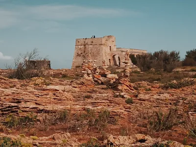 SandPunta PenneLow headland north of Brindisi with a 16th-century tower, among sandy beaches, low rocks and several beach clubs.Free · 4 beach clubs Excellent water Brindisi · Adriatic 3.3 km away
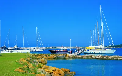 Rocks and cliffsMaterdominiThe rocky coves of Materdomini, such as Cala Licola and La Conca, as far as the marina of Brindisi, with many beach clubs.5 beach clubs Excellent water Brindisi · Adriatic 5.4 km away
Sources and licences
The data comes from public sources; before swimming check the signs and the town’s bathing ordinances.
- ARPA Puglia – Monitoraggio delle acque di balneazione (CC BY 4.0)
- Regione Puglia – Aree di balneazione e classificazione 2024 (CC BY 4.0)
- Regione Puglia – Piano Regionale delle Coste (SIT Puglia) (CC BY 4.0)
- © OpenStreetMap contributors (ODbL 1.0)
- Regione Puglia – Ricognizione dei Piani comunali delle coste (A.D. 142/2025, SIT Puglia) (CC BY 4.0)
- Wind forecast: MET Norway (CC BY 4.0).
- Data updated: Sunday, 25 October 2026.