
The beach at a glance
Low headland north of Brindisi with a 16th-century tower, among sandy beaches, low rocks and several beach clubs.
- Type of coast
- Sand
- Sand 529 m
- Pebbles 144 m
- Rocks 220 m
- Cliff 47 m
- Length
- 939 m
- Seafront
- 61% free
- 467 m free293 m leased to beach clubs
- Water quality
- Excellent · classification 2024
- Off season: latest samples of the 2026 season
- ARPA bathing areas:
- PUNTA PENNE LIDO VIGILI DEL FUOCOExcellentMon 13 Jul: within limits
- PUNTA PENNE LIDO POSTE E TELEGRAFIExcellentMon 13 Jul: within limits
- PUNTA PENNE LIDO GRANCHIO ROSSOExcellentMon 13 Jul: within limits
- ZONA PUNTA PENNEExcellentMon 13 Jul: within limits
About the beach
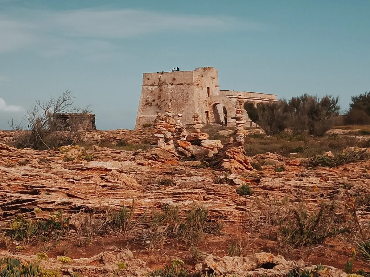
Punta Penne is a small, low, flat headland a few kilometres north of Brindisi, at the end of the Apani coastline. In just under a kilometre the coast alternates stretches of fine sand and pebbles with a long low rocky shore, as far as Cala Lopia. On the beach free stretches alternate with four beach clubs, some with a JOB chair and boardwalks for people with disabilities.
On the headland stands a 16th-century coastal tower, dated to 1582, in the Punta Penne-Punta del Serrone municipal nature park. Remains of Roman and modern-era shipwrecks have been reported in the waters off the point. The coastline is open to the winds and currents.
The car parks are close by. The sandy seabed is fine for families; on the rocks you will need water shoes. Rules protecting the environment apply in the park. The coast faces north: north (tramontana), north-east (grecale) and north-west (maestrale) winds make the sea rough, while with east (levante), south-east (scirocco), south (ostro), south-west (libeccio) and west (ponente) winds you are sheltered.
On the map
Stretch of beachBeach club
Beach clubs
On this stretch of beach or less than 300 m away.
Events nearby
In the coming days within 5 km.
Puglia Nautic Salon 2026
Collaboration between the International Nautical Salon of Puglia and Pescare Show, celebrating boating and fishing.
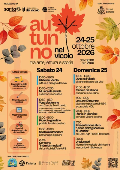
Autumn in the Alley and Piazza Duomo: Art, History and Reading
Art, history, and community celebrate autumn in Brindisi's historic center.
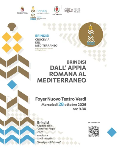
Brindisi: From the Roman Appia to the Mediterranean
Conference on the Via Appia-Traiana and Brindisi's role in the ancient Mediterranean.
Sound Matters
Female choral concert at Museo Ribezzo: exploring the possibilities of the voice.

Valentina Persia - Born with the Garter Belt
Comedy and everyday life in Valentina Persia's new show.
Things to see nearby
 Sea and cavesPunta PennaHundred-years old dunes, fine sand and clear water: Punta Penne discloses
its unspoiled beaches and the foaming waves wait for water sports’ lovers. Brindisi very close
- Sea and cavesSciai -former Pic NicThe rocky and jagged coastline of Sciaia – Former Pic Nic overlooks the Adriatic Sea, not far away from the tourist port of Brindisi. Brindisi 1.5 km away
Beaches nearby
- MixedSciaiaLow, jagged rocky shore near the small harbour of Brindisi, with small free sandy coves.Free Excellent water Brindisi · Adriatic 1.3 km away
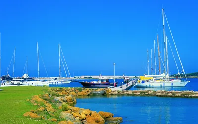 Rocks and cliffsMaterdominiThe rocky coves of Materdomini, such as Cala Licola and La Conca, as far as the marina of Brindisi, with many beach clubs.5 beach clubs Excellent water Brindisi · Adriatic 2.5 km away
- PebblesSbitriPebble and sand beach north of Brindisi, between the mouth of the Canale Giancola and Sciaia, with free stretches.Free · 2 beach clubs Excellent water Brindisi · Adriatic 3.3 km away
- SandTorre TestaSandy beach north of Brindisi, near the mouth of the Canale Giancola and the Torre Testa watchtower.Beach clubs Excellent water Natura 2000 Brindisi · Adriatic 5.6 km away
Sources and licences
The data comes from public sources; before swimming check the signs and the town’s bathing ordinances.
- ARPA Puglia – Monitoraggio delle acque di balneazione (CC BY 4.0)
- Regione Puglia – Aree di balneazione e classificazione 2024 (CC BY 4.0)
- Regione Puglia – Piano Regionale delle Coste (SIT Puglia) (CC BY 4.0)
- © OpenStreetMap contributors (ODbL 1.0)
- Regione Puglia – Ricognizione dei Piani comunali delle coste (A.D. 142/2025, SIT Puglia) (CC BY 4.0)
- Pugliapromozione – DMS Puglia, open data (stabilimenti balneari, luoghi di interesse) (CC BY 4.0)
- Wikimedia Commons (foto: autore e licenza su ogni foto) (CC0, PD, CC BY, CC BY-SA)
- salentosagreeventi.it – luoghi (foto e testi già pubblicati) (come indicato sulle foto)
- Wind forecast: MET Norway (CC BY 4.0).
- Photos: Farfalla 40, CC BY-SA 4.0 · Wikimedia Commons
- Photos: Farfalla 40, CC BY-SA 4.0 · Wikimedia Commons
- Data updated: Sunday, 25 October 2026.