
The beach at a glance
Low, jagged rocky shore near the small harbour of Brindisi, with small free sandy coves.
- Type of coast
- Mixed
- Sand 531 m
- Cliff 177 m
- Length
- 708 m
- Water quality
- Excellent · classification 2024
- Off season: latest samples of the 2026 season
- Latest samples:
- Mon 13 Jul: within limits
- Mon 15 Jun: within limits
- Tue 19 May: within limits
- Mon 20 Apr: within limits
About the beach
Sciaia, also known as ex Pic Nic, is a short stretch of the coast north of Brindisi, not far from the marina. The regional records describe it as a low, jagged rocky shore opening into small sandy coves, all free: no beach clubs, just rocks and sand.
The name comes from the former Pic Nic restaurant, very popular in the 1950s and now disused. It is a place loved by people who dive off the rocks and by anglers who take up their spots along the shore. To the north the coast continues towards Sbitri, to the south towards Punta Penne and its 16th-century tower.
The nearest listed car park is almost a kilometre away, so part of the way is on foot: bring water shoes, water and shade, because there are no services. The coast faces north: with north (tramontana), north-east (grecale) and north-west (maestrale) winds the sea gets rough, with east (levante), south-east (scirocco), south (ostro), south-west (libeccio) and west (ponente) winds it is sheltered.
On the map
Stretch of beach
Events nearby
In the coming days within 5 km.
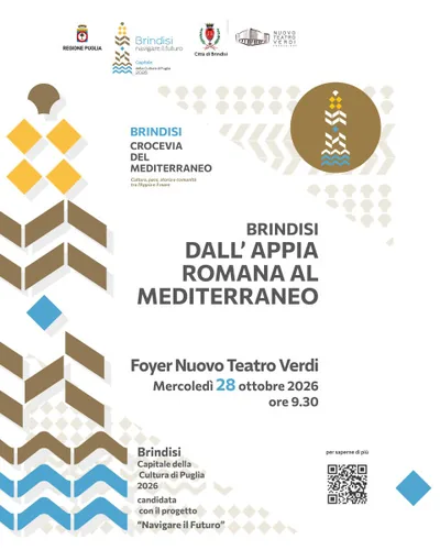
Brindisi: From the Roman Appia to the Mediterranean
Conference on the Via Appia-Traiana and Brindisi's role in the ancient Mediterranean.
Things to see nearby
- Sea and cavesSciai -former Pic NicThe rocky and jagged coastline of Sciaia – Former Pic Nic overlooks the Adriatic Sea, not far away from the tourist port of Brindisi. Brindisi very close
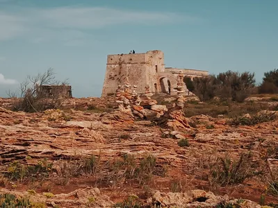 Sea and cavesPunta PennaHundred-years old dunes, fine sand and clear water: Punta Penne discloses
its unspoiled beaches and the foaming waves wait for water sports’ lovers. Brindisi 1.5 km away
Beaches nearby
- SandPunta PenneLow headland north of Brindisi with a 16th-century tower, among sandy beaches, low rocks and several beach clubs.Free · 4 beach clubs Excellent water Brindisi · Adriatic 1.3 km away
- PebblesSbitriPebble and sand beach north of Brindisi, between the mouth of the Canale Giancola and Sciaia, with free stretches.Free · 2 beach clubs Excellent water Brindisi · Adriatic 2 km away
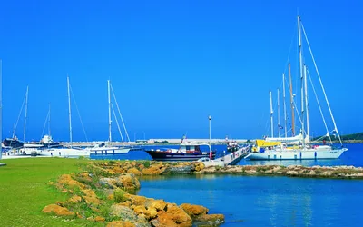 Rocks and cliffsMaterdominiThe rocky coves of Materdomini, such as Cala Licola and La Conca, as far as the marina of Brindisi, with many beach clubs.5 beach clubs Excellent water Brindisi · Adriatic 3.5 km away
- SandTorre TestaSandy beach north of Brindisi, near the mouth of the Canale Giancola and the Torre Testa watchtower.Beach clubs Excellent water Natura 2000 Brindisi · Adriatic 4.4 km away
Sources and licences
The data comes from public sources; before swimming check the signs and the town’s bathing ordinances.
- ARPA Puglia – Monitoraggio delle acque di balneazione (CC BY 4.0)
- Regione Puglia – Aree di balneazione e classificazione 2024 (CC BY 4.0)
- Regione Puglia – Piano Regionale delle Coste (SIT Puglia) (CC BY 4.0)
- © OpenStreetMap contributors (ODbL 1.0)
- Wind forecast: MET Norway (CC BY 4.0).
- Data updated: Sunday, 25 October 2026.