
The beach at a glance
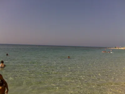
Beach of fine sand behind the dunes, all free, from the Corsica area to the mouth of the Chidro, with shallow water.
- Type of coast
- Sand
- Sand 1,949 m
- Length
- 1,949 m
- Seafront
- 100% free
- 1,949 m free0 m leased to beach clubs
- Water quality
- Excellent · classification 2024
- Off season: latest samples of the 2026 season
- ARPA bathing areas:
- SPIAGGIA LIBERA LA CORSICAExcellentTue 14 Jul: within limits
- FOCE FIUME CHIDROExcellentTue 14 Jul: within limits
- ZONA SPECCHIARICA-DISCOTECA MUNICH CLUBExcellentTue 14 Jul: within limits
- Blue Flag town
- Manduria has the Blue Flag this year
- Natura 2000 network
- ZSC Torre Colimena (IT9130001)
- Coastal erosion
- medium
About the beach
Specchiarica is the stretch of sand in Manduria that runs from the Corsica area to the mouth of the Chidro, for almost two kilometres. The sand is fine and pale, the beach is entirely free, with no beach clubs, and the seabed slopes gently, with shallow water for a long way out: that is why families like it.
You get there by leaving the car along the coast road and crossing the dunes with their Mediterranean scrub. At the mouth of the Chidro a river of fresh, very cold water forms three pools before flowing into the sea. A local legend says that the shells on this coast are the tears of Saint Peter turned to stone.
The car parks are a few steps from the beach, but there are few of them: on busy days it is best to arrive early. There are no beach clubs, so bring shade and water. Facing south, it is sheltered from the north wind (tramontana) and the other northerly winds; with south-east (scirocco), south (ostro) and south-west (libeccio) winds the sea gets rough. The beach is affected by erosion. Manduria is a Blue Flag municipality. It is part of the Torre Colimena Natura 2000 site.
On the map
Stretch of beach
Events nearby
In the coming days within 5 km.
No events within 5 km in the coming days.
Things to see nearby
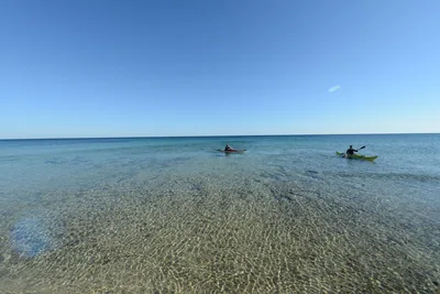
Beaches nearby
 SandSan Pietro in BevagnaBeach of soft sand over four kilometres long, almost all free, with shallow water and the sanctuary of San Pietro.Free · 2 beach clubs Excellent water Blue Flag town Natura 2000 Manduria · Ionian 3.2 km away
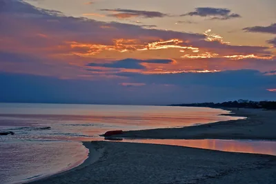
 SandTorre ColimenaBay of soft sand, all free, with rocky shore towards the tower and the Salina dei Monaci behind, in a nature reserve.Free Excellent water Blue Flag town Protected area Manduria · Ionian 3.3 km away
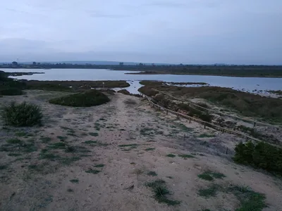
 SandPunta ProsciuttoLong beach of white sand, largely free, among dunes and scrub, with shallow water, in the Palude del Conte reserve.Free · 3 beach clubs Excellent water Protected area Porto Cesareo · Ionian 6.1 km away
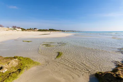
 SandTorre BorracoSandy beach, all free, about two kilometres long, with a ridge of dunes behind, towards the Borraco river.Free Excellent water Blue Flag town Natura 2000 Manduria · Ionian 6.2 km away
Sources and licences
The data comes from public sources; before swimming check the signs and the town’s bathing ordinances.
- ARPA Puglia – Monitoraggio delle acque di balneazione (CC BY 4.0)
- Regione Puglia – Aree di balneazione e classificazione 2024 (CC BY 4.0)
- Regione Puglia – Piano Regionale delle Coste (SIT Puglia) (CC BY 4.0)
- © OpenStreetMap contributors (ODbL 1.0)
- Regione Puglia – Ricognizione dei Piani comunali delle coste (A.D. 142/2025, SIT Puglia) (CC BY 4.0)
- Regione Puglia – Perimetrazione dei siti Natura 2000 (12/2023) (CC BY 4.0)
- FEE Italia – Bandiera Blu 2026 (dato pubblico (elenco dei comuni premiati))
- Wind forecast: MET Norway (CC BY 4.0).
- Data updated: Sunday, 25 October 2026.