
The beach at a glance
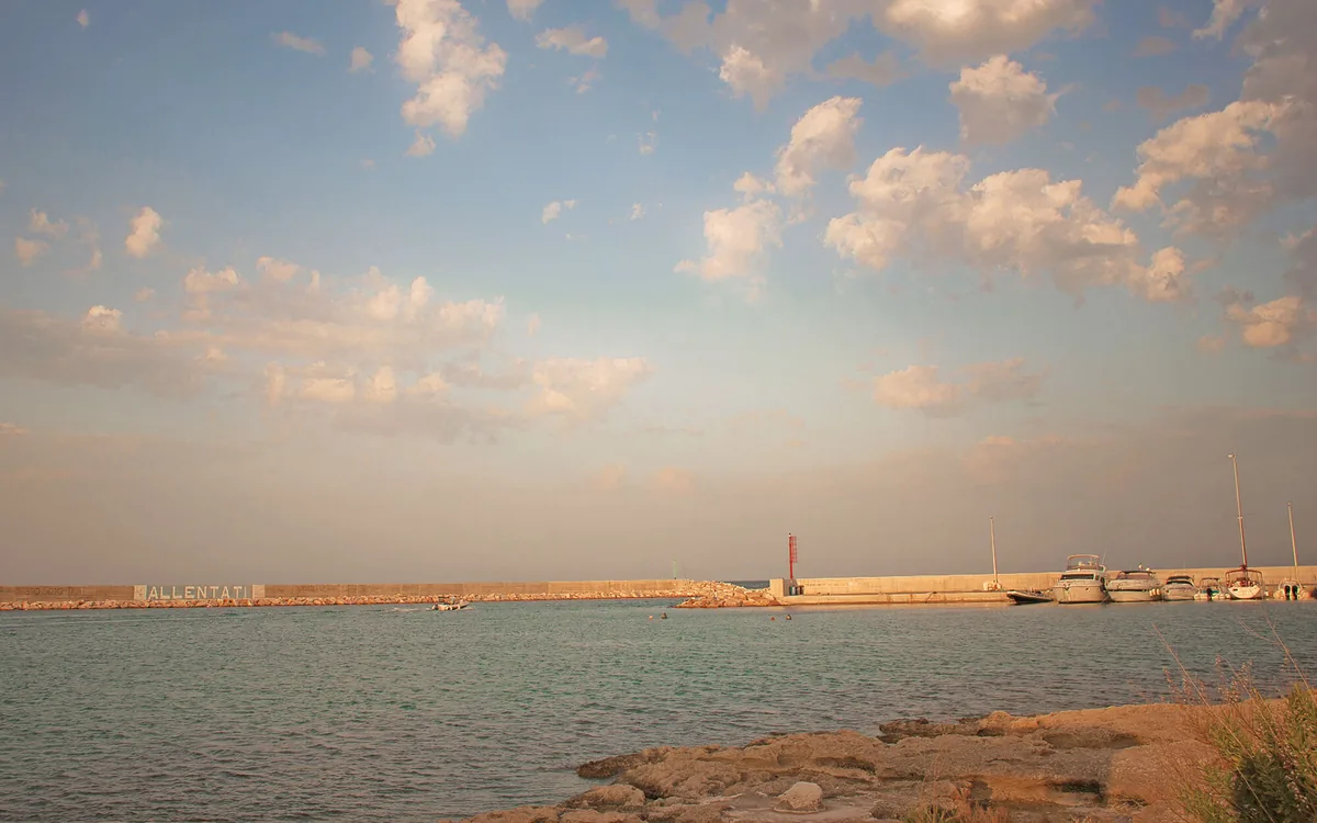
Low rocky coast around the fishing village of Savelletri, with a few sandy coves, beach clubs and free stretches.
- Type of coast
- Mixed
- Sand 27 m
- Rocks 4,611 m
- Man-made 60 m
- Length
- 4,698 m
- Seafront
- 45% free
- 717 m free859 m leased to beach clubs
- Water quality
- Excellent · classification 2024
- Off season: latest samples of the 2026 season
- ARPA bathing areas:
- SAVELLETRI RISTORANTE "LA SORGENTE"ExcellentThu 16 Jul: within limits
- SAVELLETRI LIDO SIRENETTAExcellentThu 16 Jul: within limits
- CALA PALMIERIExcellentThu 16 Jul: within limits
- Blue Flag town
- Fasano has the Blue Flag this year
About the beach
Savelletri is a small fishing village in the municipality of Fasano and its coast is almost entirely low rocky shore: nearly five kilometres of flat, jagged rock, with a few coves of soft sand opening between the rocks. Much of the beachfront is taken up by beach clubs; the free stretches are shorter and mostly on the rocks.
In the middle is the small fishing harbour, sheltered by a long pier, and after your swim you can taste sea urchins in the village. To the north, along the rocky shore, stand the old buildings known as Case Bianche and, less than two kilometres away, the Egnazia archaeological area. A Hellenistic-era wreck has been documented on the seabed nearby.
The car parks are close to the coast. To get into the water from the rocks, bring water shoes; on the sandy stretches the seabed slopes gently. The coast faces north-east: north (tramontana), north-east (grecale) and east (levante) winds make the sea rough, while with south-east (scirocco), south (ostro), south-west (libeccio), west (ponente) and north-west (maestrale) winds you are sheltered.
On the map
Stretch of beachBeach club
Beach clubs
On this stretch of beach or less than 300 m away.
Events nearby
In the coming days within 5 km.
No events within 5 km in the coming days.
Things to see nearby
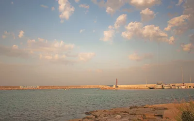 Sea and cavesPort of SavelletriIn Savelletri, a small fishing port is enclosed by a 330 m long headland mole and a smaller, paved breakwater mole. Fasano very close
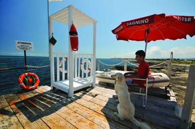 Sea and cavesSavelletriThe fishermen’s village of Savelletri, amid coves with soft sand and
turquoise sea, dives and happy hours, has to be experience, also together
with your four-legged friends. Fasano very close
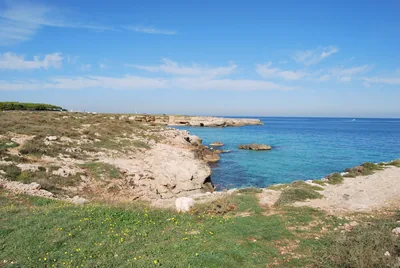 Sea and cavesEgnazia - Case biancheThe beach Egnazia – case bianche, amid sandy coves and low rocky coast,
keeps the ruins of the ancient Messapic culture, a few steps away from
clear water. Fasano 2.6 km away
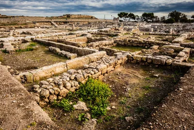 ArchaeologyEgnazia Archaeological ParkThe Egnazia Archaeological Park is a wonderful site full of extraordinary
artefacts from the Messapian and Roman eras. Fasano 2.9 km away
Beaches nearby
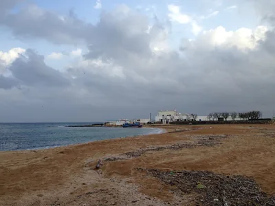 MixedLa ForcatellaLow coast between Savelletri and Torre Canne, with flat rocks and free coves of sand and pebbles, good for families.Free · 1 beach club Excellent water Blue Flag town Fasano · Adriatic 1.8 km away
- Rocks and cliffsEgnaziaLow rocky shore with small sandy coves below the Egnazia archaeological area, with free stretches and one beach club.Free · 1 beach club Excellent water Blue Flag town Fasano · Adriatic 2.3 km away
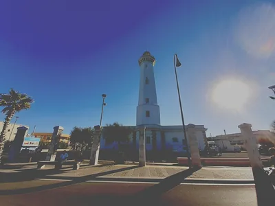 Rocks and cliffsTorre Canne nordLow rocky shore with a few sandy coves north of the Torre Canne lighthouse, largely free.Free · 1 beach club Excellent water Blue Flag town Fasano · Adriatic 4.8 km away
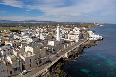 SandTorre CanneThe village's fine sandy beach, from the harbour to the beach clubs, with many free stretches and shallow water for children.Free · 2 beach clubs Excellent water Blue Flag town Protected area Fasano · Adriatic 6.4 km away
Sources and licences
The data comes from public sources; before swimming check the signs and the town’s bathing ordinances.
- ARPA Puglia – Monitoraggio delle acque di balneazione (CC BY 4.0)
- Regione Puglia – Aree di balneazione e classificazione 2024 (CC BY 4.0)
- Regione Puglia – Piano Regionale delle Coste (SIT Puglia) (CC BY 4.0)
- © OpenStreetMap contributors (ODbL 1.0)
- Regione Puglia – Ricognizione dei Piani comunali delle coste (A.D. 142/2025, SIT Puglia) (CC BY 4.0)
- Pugliapromozione – DMS Puglia, open data (stabilimenti balneari, luoghi di interesse) (CC BY 4.0)
- Wikimedia Commons (foto: autore e licenza su ogni foto) (CC0, PD, CC BY, CC BY-SA)
- salentosagreeventi.it – luoghi (foto e testi già pubblicati) (come indicato sulle foto)
- FEE Italia – Bandiera Blu 2026 (dato pubblico (elenco dei comuni premiati))
- Wind forecast: MET Norway (CC BY 4.0).
- Photos: Daniele Corricciati · Regione Puglia
- Photos: Orubino, Public domain · Wikimedia Commons
- Photos: Regione Puglia, CC BY-SA 3.0 IT · Wikimedia Commons
- Photos: Laterza Giovanni, CC BY-SA 4.0 · Wikimedia Commons
- Photos: Laterza Giovanni, CC BY-SA 4.0 · Wikimedia Commons
- Photos: Carlo Elmiro Bevilacqua · Regione Puglia
- Data updated: Sunday, 25 October 2026.