
Rocks and cliffs Blue Flag town Excellent water Natura 2000For families
Santa Caterina
Nardò (LE)· Sea: Ionian
The beach at a glance
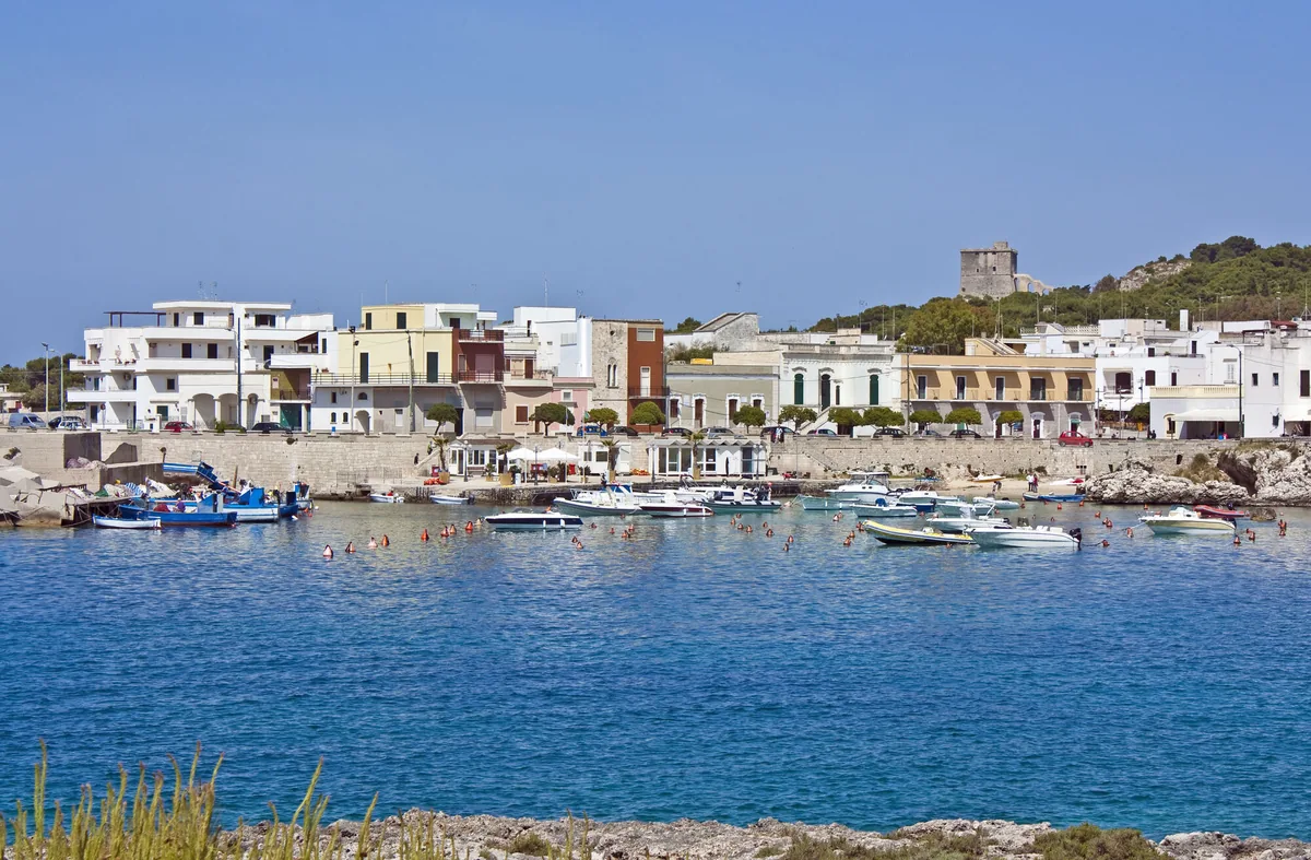
Rocky coast with a small sandy bay, small harbour, caves and an islet, as far as Torre dell'Alto at the edge of the park.
- Type of coast
- Rocks and cliffs
- Sand 94 m
- Rocks 3,879 m
- Cliff 981 m
- Man-made 227 m
- Length
- 5,179 m
- Seafront
- 31% free
- 326 m free716 m leased to beach clubs
- Water quality
- Excellent · classification 2024
- Off season: latest samples of the 2026 season
- ARPA bathing areas:
- SANTA CATERINAExcellentWed 15 Jul: within limits
- 200 MT S.TORRE DELL'ALTOExcellentWed 15 Jul: within limits
- Blue Flag town
- Nardò has the Blue Flag this year
- Natura 2000 network
- ZSC Torre Uluzzo (IT9150007)
About the beach
Santa Caterina is a seaside village of Nardò enclosed between the tower of the same name, to the south, and Torre dell'Alto, to the north, at the edge of the Porto Selvaggio park. The coast is low and rocky, with higher stretches to the north; in the middle is a small sandy bay, with a beach club and a little free beach, where the seabed slopes gently but the sand soon gives way to stones and rocks. Elsewhere you get into the water from the rock, with water shoes.
Next to the bay is the small harbour with the fishermen's boats, and from here canoe trips and dives set off along the coast towards the park. In the bay further north, at the foot of Torre dell'Alto, there is an islet, and caves with green-blue water open in the rock walls. In Messapian times the port of Nardò was here.
The car parks are close by. Nardò is a Blue Flag municipality. The coast faces south-west: with north (tramontana), north-east (grecale), east (levante), south-east (scirocco) and north-west (maestrale) winds it is sheltered, with south (ostro), south-west (libeccio) and west (ponente) winds the sea gets rough. It is part of the Torre Uluzzo Natura 2000 site.
On the map
Stretch of beachBeach club
Beach clubs
On this stretch of beach or less than 300 m away.
Spiaggia Santa Caterina Beach
- Services for people with disabilities: sedia JOB
Lido Beija-Flor
Events nearby
In the coming days within 5 km.
No events within 5 km in the coming days.
Things to see nearby
 Sea and cavesSanta CaterinaDiving in the clear water, by canoes or simply relaxing on the small sandy
beach, discover the amazing cliff of Santa Caterina. Nardò very close
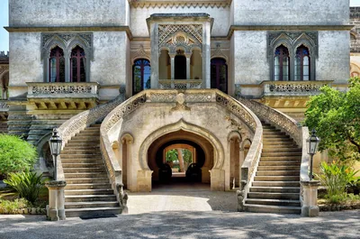 Castles, towers and palacesHistoric Villas of CenateGroup of extraordinary Baroque villas in the locality of Cenate, a stone's
throw from Nardò. Nardò very close
 Sea and cavesSanta Caterina harbourIn Santa Caterina, a district of Nardò, there is a small harbor with a 35 m long paved pier and a 40 m long riverside dock on the western… Nardò very close
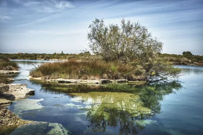 Nature and gardensRegional Nature Park Porto Selvaggio e Palude del CapitanoA thick pine forest, a cliff overlooking the blue sea and a marsh riches
with “spunnulate”: here the wild nature is to be discovered. Nardò 1.7 km away
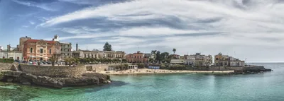 Sea and cavesSanta Maria al BagnoThe small sandy beach of Santa Maria al Bagno, nestled in the low and rocky
coast, from which one can dive in the blue sea, is protected by the winds
and lapped by the green-blue sea. Nardò 1.7 km away
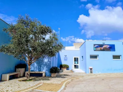 Museums and theatresAquario del SalentoA 250-square-meter indoor and 800-square-meter outdoor exhibition space
with 23 seawater tanks all to be discovered. Nardò 1.9 km away
Beaches nearby
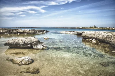 Rocks and cliffsPorto SelvaggioPebble bay among Aleppo pines and rocky shore, with cold springs and coves, to be reached on foot in the park.Free Excellent water Blue Flag town Protected area Nardò · Ionian 1.6 km away
- Rocks and cliffsSanta Maria al BagnoSmall sandy beach in the village, among low rocks with steps for diving, as far as the Quattro Colonne and the Reggia.1 beach club Excellent water Blue Flag town Natura 2000 Nardò, Galatone · Ionian 2.1 km away
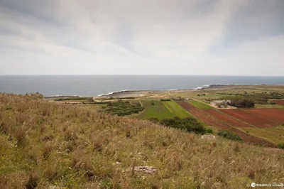 Rocks and cliffsSerra CicoraLong, low and rugged rocky shore between Torre Uluzzo and Torre Inserraglio, hard to reach, in the Porto Selvaggio park.1 beach club Excellent water Blue Flag town Protected area Nardò · Ionian 4.4 km away
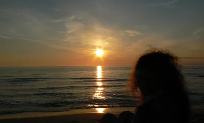 SandLido ConchiglieSandy beach almost two kilometres long below the Altolido ridge, with free stretches, a few beach clubs and stretches of high coast.Free · 4 beach clubs Excellent water Blue Flag town Natura 2000 Gallipoli · Ionian 4.7 km away
Sources and licences
The data comes from public sources; before swimming check the signs and the town’s bathing ordinances.
- ARPA Puglia – Monitoraggio delle acque di balneazione (CC BY 4.0)
- Regione Puglia – Aree di balneazione e classificazione 2024 (CC BY 4.0)
- Regione Puglia – Piano Regionale delle Coste (SIT Puglia) (CC BY 4.0)
- © OpenStreetMap contributors (ODbL 1.0)
- Regione Puglia – Ricognizione dei Piani comunali delle coste (A.D. 142/2025, SIT Puglia) (CC BY 4.0)
- Regione Puglia – Perimetrazione dei siti Natura 2000 (12/2023) (CC BY 4.0)
- Pugliapromozione – DMS Puglia, open data (stabilimenti balneari, luoghi di interesse) (CC BY 4.0)
- Wikimedia Commons (foto: autore e licenza su ogni foto) (CC0, PD, CC BY, CC BY-SA)
- salentosagreeventi.it – luoghi (foto e testi già pubblicati) (come indicato sulle foto)
- FEE Italia – Bandiera Blu 2026 (dato pubblico (elenco dei comuni premiati))
- Wind forecast: MET Norway (CC BY 4.0).
- Photos: — · Regione Puglia
- Photos: User:Nikater, CC BY-SA 3.0 · Wikimedia Commons
- Photos: User:Nikater, CC BY-SA 3.0 · Wikimedia Commons
- Photos: fedewild from Rome, ITALY, CC BY-SA 2.0 · Wikimedia Commons
- Photos: Luca Margheriti, CC BY-SA 3.0 · Wikimedia Commons
- Photos: Luca Margheriti, CC BY-SA 3.0 · Wikimedia Commons
- Photos: Luca Margheriti, CC BY-SA 3.0 · Wikimedia Commons
- Photos: Luca Margheriti, CC BY-SA 3.0 · Wikimedia Commons
- Photos: Luca Margheriti, CC BY-SA 3.0 · Wikimedia Commons
- Photos: Luca Margheriti, CC BY-SA 3.0 · Wikimedia Commons
- Data updated: Sunday, 25 October 2026.