
Sand Blue Flag town Excellent water Natura 2000For families
San Cataldo
Lecce (LE),Vernole (LE)· Sea: Adriatic
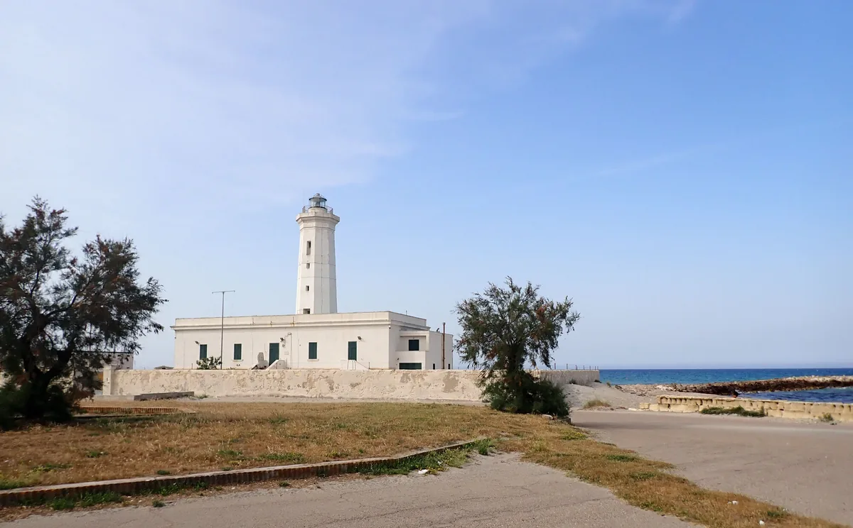
The beach at a glance
The sandy beach of the people of Lecce: kilometres of beach clubs and free stretches between the groynes, from the dock to the Rotonda.
- Type of coast
- Sand
- Sand 4,909 m
- Man-made 1,209 m
- Length
- 6,118 m
- Seafront
- 67% free
- 4,120 m free1,998 m leased to beach clubs
- Water quality
- Excellent · classification 2024
- Off season: latest samples of the 2026 season
- ARPA bathing areas:
- 300 MT SUD DARSENAExcellentMon 6 Jul: within limits
- SAN CATALDO-VICINO AL FAROExcellentMon 6 Jul: within limits
- SAN CATALDO-SPIAGGIA LIBERAExcellentMon 6 Jul: within limits
- SAN CATALDO-LA ROTONDAExcellentMon 6 Jul: within limits
1 more areas
- SAN CATALDO-STAB.STELLA DEL SUDExcellentMon 6 Jul: within limits
- Blue Flag town
- Lecce has the Blue Flag this year
- Natura 2000 network
- ZSC Torre Veneri (IT9150025)
- Coastal erosion
- low
About the beach
San Cataldo, about a dozen kilometres from Lecce, has always been the beach of the people of Lecce. The fine sand runs for over six kilometres, from the dock in the north to the Rotonda and beyond the boundary with Vernole, broken up by the groynes, the rock barriers built against erosion. The beach clubs, with their masonry cabins, alternate with free stretches, which still make up most of the seafront.
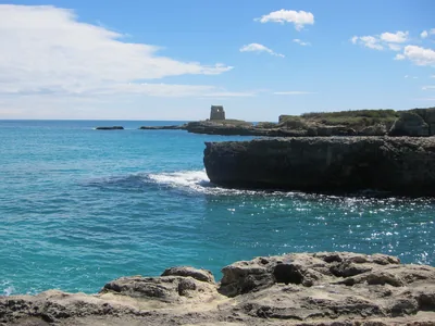
Near the lighthouse are the remains of the Roman pier attributed to the emperor Hadrian, when Lecce was Lupiae: this is why the landing place was called Porto Adriano. It is part of the Torre Veneri Natura 2000 site. For a whole day on the sand it is suitable for families, and some beach clubs have a bar, wheelchair access or reserved parking. The nearest car parks are a few steps from the beach.
The best swimming is with the south-east wind (scirocco) and winds from the south, especially in the morning, when the sea is calm; the coast is also sheltered with south-west (libeccio), west (ponente) and north-west (maestrale) winds, while north (tramontana), north-east (grecale) and east (levante) winds make the sea rough. Lecce is a Blue Flag municipality.
On the map
Stretch of beachBeach club
Beach clubs
On this stretch of beach or less than 300 m away.
Lido Pachamama
- Services for people with disabilities: parcheggi riservati
Soleluna Lido Bau Beach
Bar · Cassaforte / cassette di sicurezza · Punto ristoro
- Pets allowed
- Parking
Lido Pacha Mama
- Services for people with disabilities: accessibile in carrozzina
Lido Turrisi
Bar
- Services for people with disabilities: parcheggi riservati
Lido York
Events nearby
In the coming days within 5 km.
No events within 5 km in the coming days.
Things to see nearby
 Castles, towers and palacesSan Cataldo LighthouseAncient lighthouse overlooking the maritime hamlet of San Cataldo, built
near the remains of an ancient pier from the Roman era. Lecce very close
 Sea and cavesSan CataldoA moored dock managed by \"Darsena Salento\" located in the immediate hinterland of San Cataldo di Lecce, accessible via a canal. Lecce very close
Beaches nearby
 SandFrigoleOver seven kilometres of even sand, with dunes and long free stretches, from the Lago Grande to south of Frigole.Free · 7 beach clubs Excellent water Blue Flag town Natura 2000 Lecce · Adriatic 6.4 km away
 SandLe CesineSeven kilometres of sand and dunes, almost all free, in front of the Le Cesine oasis, with Le Ficherelle and Al Ponticello.Free · 3 beach clubs Excellent water Protected area Vernole · Adriatic 6.5 km away
Sources and licences
The data comes from public sources; before swimming check the signs and the town’s bathing ordinances.
- ARPA Puglia – Monitoraggio delle acque di balneazione (CC BY 4.0)
- Regione Puglia – Aree di balneazione e classificazione 2024 (CC BY 4.0)
- Regione Puglia – Piano Regionale delle Coste (SIT Puglia) (CC BY 4.0)
- © OpenStreetMap contributors (ODbL 1.0)
- Regione Puglia – Ricognizione dei Piani comunali delle coste (A.D. 142/2025, SIT Puglia) (CC BY 4.0)
- Regione Puglia – Perimetrazione dei siti Natura 2000 (12/2023) (CC BY 4.0)
- Pugliapromozione – DMS Puglia, open data (stabilimenti balneari, luoghi di interesse) (CC BY 4.0)
- Wikimedia Commons (foto: autore e licenza su ogni foto) (CC0, PD, CC BY, CC BY-SA)
- salentosagreeventi.it – luoghi (foto e testi già pubblicati) (come indicato sulle foto)
- FEE Italia – Bandiera Blu 2026 (dato pubblico (elenco dei comuni premiati))
- Wind forecast: MET Norway (CC BY 4.0).
- Photos: Patrice78500 · Regione Puglia
- Photos: Patrice78500, CC BY-SA 4.0 · Wikimedia Commons
- Photos: Cesare Barillà, CC BY-SA 4.0 · Wikimedia Commons
- Photos: Cesare Barillà, CC BY-SA 4.0 · Wikimedia Commons
- Photos: Cesare Barillà, CC BY-SA 4.0 · Wikimedia Commons
- Photos: Michael Paraskevas, CC BY-SA 3.0 · Wikimedia Commons
- Photos: Colar, Public domain · Wikimedia Commons
- Photos: Cesare Barillà, CC BY-SA 4.0 · Wikimedia Commons
- Photos: Regione Puglia, CC BY-SA 3.0 IT · Wikimedia Commons
- Data updated: Sunday, 25 October 2026.