
The beach at a glance
Coast of low cliffs and rocks on the Ostuni seafront, with a few small sandy coves.
- Type of coast
- Mixed
- Sand 202 m
- Rocks 1,168 m
- Cliff 3,547 m
- Length
- 5,113 m
- Seafront
- 69% free
- 1,225 m free540 m leased to beach clubs
- Water quality
- Excellent · classification 2024
- Off season: latest samples of the 2026 season
- ARPA bathing areas:
- COSTA MERLATA DI FRONTE A VIA DEL MAREExcellentWed 15 Jul: within limits
- COSTA MERLATA STRADA CON CASA ROSSAExcellentWed 15 Jul: within limits
- Blue Flag town
- Ostuni has the Blue Flag this year
About the beach
Costa Merlata is a stretch of the Ostuni coastline over five kilometres long, made up largely of low cliffs and rocks, with a few small sandy coves. The beachfront alternates free stretches with stretches with facilities on the rock.
It is a rocky coast: you reach the sea by climbing down from the rock, and the sandy coves are few and small. To the north-west the rocky coast continues as far as Villanova and its small harbour; to the south-east you reach Torre Pozzella.
The car parks are about half a kilometre away: part of the way is on foot, so it is best to bring water shoes, water and shade. Along the cliffs, look for access to the sea at the lowest points. The coast faces north: with north (tramontana), north-east (grecale) and north-west (maestrale) winds the waves roll in, while with east (levante), south-east (scirocco), south (ostro), south-west (libeccio) and west (ponente) winds the sea is calm. Ostuni is a Blue Flag municipality.
On the map
Stretch of beach
Events nearby
In the coming days within 5 km.
No events within 5 km in the coming days.
Things to see nearby
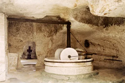 Farmhouses and oil millsThe ‘’Lacopagliaro’’ underground oil millAn hypogeum of medieval origin, the underground oil mil Lacopagliaro in
Ostuni holds several spaces in its bowels destined to the production of
oil. Ostuni 3.6 km away
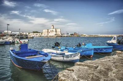 Sea and cavesVillanovaFrom the shades of the sea to the lively tourist port: the beach of
Villanova appears a few step away from the “white town”. Ostuni 4.2 km away
- Sea and cavesTorre Santa Sabina/MezzalunaTorre Santa Sabina, with its wonderful cliffs and sandy beaches, awaits visitors to dive in the Adriatic Sea. Carovigno 4.9 km away
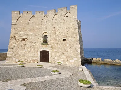 Castles, towers and palacesTorre Santa SabinaTorre Santa Sabina, imbued with the scent of salt, is a characteristic
building by the coast, a few steps away from the town centre of the borough
of Carovigno. Carovigno 5 km away
Beaches nearby
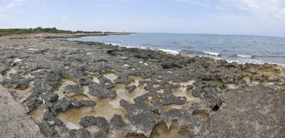 MixedTorre PozzellaCoast of low cliffs between Santa Lucia and Lamaforca, with small sandy coves and rocks.Beach clubs Excellent water Blue Flag town Ostuni · Adriatic 1.6 km away
- MixedGorgognoloCoast of rocks and low cliffs between Villanova and Costa Merlata, with almost no sand and far from the car parks.Beach clubs Excellent water Blue Flag town Ostuni · Adriatic 1.8 km away
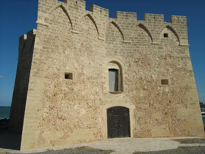 MixedSpiaggia della MezzalunaRocky shore north of Torre Santa Sabina, with the diving spots of La Gola and the small crescent-shaped Mezzaluna beach.Free · 2 beach clubs Excellent water Blue Flag town Carovigno · Adriatic 3.8 km away
- MixedVillanovaRocky coast with small coves around the small harbour of Villanova and its castle, with free stretches and beach clubs.Free · beach clubs Excellent water Blue Flag town Ostuni · Adriatic 4.2 km away
Sources and licences
The data comes from public sources; before swimming check the signs and the town’s bathing ordinances.
- ARPA Puglia – Monitoraggio delle acque di balneazione (CC BY 4.0)
- Regione Puglia – Aree di balneazione e classificazione 2024 (CC BY 4.0)
- Regione Puglia – Piano Regionale delle Coste (SIT Puglia) (CC BY 4.0)
- © OpenStreetMap contributors (ODbL 1.0)
- Regione Puglia – Ricognizione dei Piani comunali delle coste (A.D. 142/2025, SIT Puglia) (CC BY 4.0)
- FEE Italia – Bandiera Blu 2026 (dato pubblico (elenco dei comuni premiati))
- Wind forecast: MET Norway (CC BY 4.0).
- Data updated: Sunday, 25 October 2026.