
The beach at a glance
Coast of rocks and low cliffs between Villanova and Costa Merlata, with almost no sand and far from the car parks.
- Type of coast
- Mixed
- Sand 38 m
- Rocks 3,582 m
- Cliff 2,166 m
- Length
- 5,786 m
- Seafront
- 584 m free144 m leased to beach clubs
- Water quality
- Excellent · classification 2024
- Off season: latest samples of the 2026 season
- ARPA bathing areas:
- LOCALITA' PROCACCIOExcellentWed 15 Jul: within limits
- ZONA GORGOGNOLO NUOVOExcellentWed 15 Jul: within limits
- FOSSO PUNTORE DI FRONTE STRADA VICINALEExcellentWed 15 Jul: within limits
- Blue Flag town
- Ostuni has the Blue Flag this year
About the beach
Gorgognolo is a stretch of rocky coast almost six kilometres long between Villanova and Costa Merlata, on the Ostuni seafront, which also includes the Procaccio area and the Fosso Puntore. Low rocks alternate with stretches of cliff; there is almost no sand and very few stretches with facilities.
It is a coast for those who love swimming off the rocks and are looking for space. The nearest village is Villanova, less than a kilometre away, with its small harbour overlooked by the Angevin castle and services for the day.
The nearest listed car park is over half a kilometre away: you get there on foot, with water shoes for the rocks and bringing water and shade. Where the coast is high, choose your way into the sea carefully, at the lowest points. The coast faces north: with north (tramontana), north-east (grecale) and north-west (maestrale) winds the sea gets rough, with east (levante), south-east (scirocco), south (ostro), south-west (libeccio) and west (ponente) winds it is sheltered.
On the map
Stretch of beach
Events nearby
In the coming days within 5 km.
No events within 5 km in the coming days.
Things to see nearby
Beaches nearby
- MixedCosta MerlataCoast of low cliffs and rocks on the Ostuni seafront, with a few small sandy coves.Free · beach clubs Excellent water Blue Flag town Ostuni · Adriatic 1.8 km away
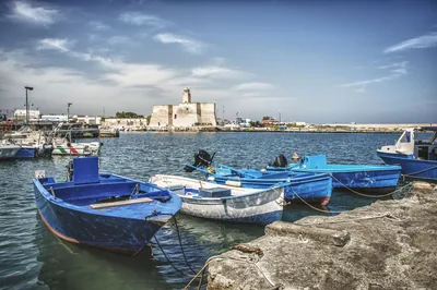 MixedVillanovaRocky coast with small coves around the small harbour of Villanova and its castle, with free stretches and beach clubs.Free · beach clubs Excellent water Blue Flag town Ostuni · Adriatic 2.3 km away
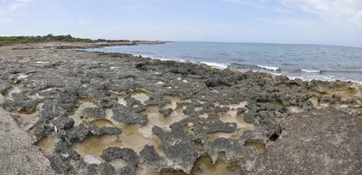 MixedTorre PozzellaCoast of low cliffs between Santa Lucia and Lamaforca, with small sandy coves and rocks.Beach clubs Excellent water Blue Flag town Ostuni · Adriatic 3.4 km away
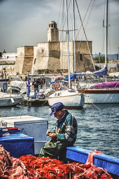 MixedDiana MarinaLow rocky shore next to the small harbour of Villanova, with a scrap of sand and free access to the sea.Free Excellent water Blue Flag town Ostuni · Adriatic 4.5 km away
Sources and licences
The data comes from public sources; before swimming check the signs and the town’s bathing ordinances.
- ARPA Puglia – Monitoraggio delle acque di balneazione (CC BY 4.0)
- Regione Puglia – Aree di balneazione e classificazione 2024 (CC BY 4.0)
- Regione Puglia – Piano Regionale delle Coste (SIT Puglia) (CC BY 4.0)
- © OpenStreetMap contributors (ODbL 1.0)
- Regione Puglia – Ricognizione dei Piani comunali delle coste (A.D. 142/2025, SIT Puglia) (CC BY 4.0)
- FEE Italia – Bandiera Blu 2026 (dato pubblico (elenco dei comuni premiati))
- Wind forecast: MET Norway (CC BY 4.0).
- Data updated: Sunday, 25 October 2026.