
Beaches of Salento
Sand or rocks, free or with beach clubs, on the Adriatic or the Ionian: for every beach the water quality, the services and which winds leave it calm. Check today’s wind and pick the right coast.
27 beaches · Clear
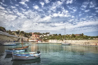 Rocks and cliffsTricase PortoLow rocky coast with caves and coves, two small harbours and an islet a few strokes away, from the Serra del Mito to San Nicola.Free Excellent water Blue Flag town Protected area Tricase · Adriatic
- Rocks and cliffsBaia d'ArgentoRocky coast with a small harbour for boats, in Leporano: no sand, you get into the water from the rocks.Free Excellent water Blue Flag town Natura 2000 Leporano · Ionian
- Rocks and cliffsTorre Santo StefanoCliffs and rocks with small coves between the Baia dei Turchi and Otranto, from Vigna Vecchia to Mulino d'Acqua, with no sand.1 beach club Excellent water Natura 2000 Otranto · Adriatic
Wind forecast by MET Norway (CC BY 4.0), for central Salento. Sources and licences: ARPA Puglia – Monitoraggio delle acque di balneazione (CC BY 4.0) · Regione Puglia – Aree di balneazione e classificazione 2024 (CC BY 4.0) · Regione Puglia – Piano Regionale delle Coste (SIT Puglia) (CC BY 4.0) · Regione Puglia – Ricognizione dei Piani comunali delle coste (A.D. 142/2025, SIT Puglia) (CC BY 4.0) · Regione Puglia – Parchi e riserve naturali (rev. 11/2022) (CC BY 4.0) · Regione Puglia – Perimetrazione dei siti Natura 2000 (12/2023) (CC BY 4.0) · Pugliapromozione – DMS Puglia, open data (stabilimenti balneari, luoghi di interesse) (CC BY 4.0) · © OpenStreetMap contributors (ODbL 1.0) · Wikimedia Commons (foto: autore e licenza su ogni foto) (CC0, PD, CC BY, CC BY-SA) · salentosagreeventi.it – luoghi (foto e testi già pubblicati) (come indicato sulle foto) · FEE Italia – Bandiera Blu 2026 (dato pubblico (elenco dei comuni premiati))