
The beach at a glance
Small bay of very pale sand among the rocks, below the headland of the Saturo archaeological park, with shallow water.
- Type of coast
- Sand
- Sand 303 m
- Rocks 244 m
- Length
- 547 m
- Seafront
- 68% free
- 240 m free111 m leased to beach clubs
- Water quality
- Excellent · classification 2024
- Off season: latest samples of the 2026 season
- Latest samples:
- Mon 13 Jul: within limits
- Mon 15 Jun: within limits
- Mon 18 May: within limits
- Mon 20 Apr: within limits
- Blue Flag town
- Leporano has the Blue Flag this year
About the beach
The bay of Saturo, in Marina di Leporano, is a stretch of just over half a kilometre: about 300 metres of very pale sand, the rest rocks. The beach is largely free, with one beach club; the water is clear and shallow, suitable for children.
On the headland next to it is the Saturo archaeological park, ancient Satyrion, which tradition links to the founding of Taranto. Traces of human presence from the Neolithic to the early Middle Ages have been found there: a Bronze Age village, two Greek sanctuaries and a large Roman villa. In the park stands Torre Saturo, built in the second half of the 16th century against pirate raids and reused during the Second World War.
The car parks are a few steps away. On the rocks you will need water shoes. The bay faces south-west: with north (tramontana), north-east (grecale), east (levante) and south-east (scirocco) winds the sea is calm, with south (ostro), south-west (libeccio) and west (ponente) winds it gets rough. Leporano is a Blue Flag municipality.
On the map
Stretch of beachBeach club
Beach clubs
On this stretch of beach or less than 300 m away.
Canneto Beach
Events nearby
In the coming days within 5 km.
No events within 5 km in the coming days.
Things to see nearby
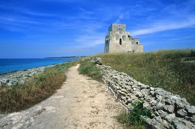 ArchaeologySaturo Archeological ParkRemains of a Roman villa and a Roman spa on a picturesque promontory of the
Ionian riviera Leporano very close
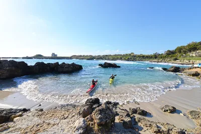 Sea and cavesMarina di LeporanoNatural coves with fine sand nestle along the rocky coastline of the
Marina di Leporano, caressed by the colours of the Ionian sea. Leporano very close
- Sea and cavesLido GandoliLido Gandoli is a small, moored inlet with a loading crane, located in a state-owned maritime area leased to a private company. Leporano very close
Beaches nearby
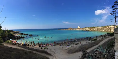 MixedPorto PirroneRocky coast with two small sandy inlets among the rocks, below a campsite, next to the Saturo archaeological park.Free Excellent water Blue Flag town Natura 2000 Leporano · Ionian very close
- SandGandoliLeporano bay with a short stretch of soft sand among the rocks and shallow water, partly free and partly with facilities.1 beach club Excellent water Blue Flag town Leporano · Ionian 1 km away
- Rocks and cliffsBaia d'ArgentoRocky coast with a small harbour for boats, in Leporano: no sand, you get into the water from the rocks.Free Excellent water Blue Flag town Natura 2000 Leporano · Ionian 2.4 km away
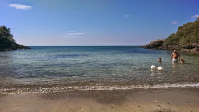 MixedBaia di Porto CupoRocky inlet in Taranto with very little sand, taken up by a bathing facility; outside it, only rocks.1 beach club Excellent water Taranto · Ionian 2.6 km away
Sources and licences
The data comes from public sources; before swimming check the signs and the town’s bathing ordinances.
- ARPA Puglia – Monitoraggio delle acque di balneazione (CC BY 4.0)
- Regione Puglia – Aree di balneazione e classificazione 2024 (CC BY 4.0)
- Regione Puglia – Piano Regionale delle Coste (SIT Puglia) (CC BY 4.0)
- © OpenStreetMap contributors (ODbL 1.0)
- Regione Puglia – Ricognizione dei Piani comunali delle coste (A.D. 142/2025, SIT Puglia) (CC BY 4.0)
- FEE Italia – Bandiera Blu 2026 (dato pubblico (elenco dei comuni premiati))
- Wind forecast: MET Norway (CC BY 4.0).
- Data updated: Sunday, 25 October 2026.